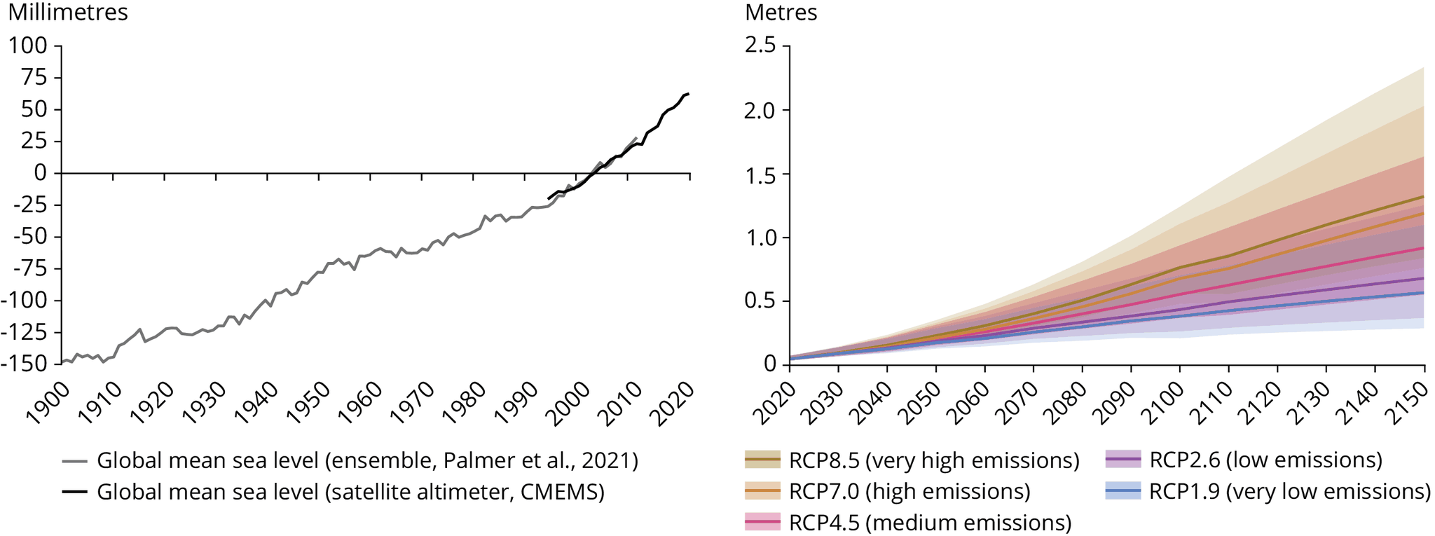
For Palmer et al., 2021, the data is the result of an ensemble approach to quantify historical global mean sea-level (GMSL) rise based on tide gauge reconstructions. The approach combines the maximum internal uncertainty across the ensemble with an estimate of structural uncertainty to provide a conservative estimate of the total uncertainty. Comparisons of GMSL rise over the 20th century based on deltas and linear trends (and their respective uncertainties) are consistent with past Intergovernmental Panel on Climate Change assessments and show good agreement with satellite altimeter timeseries. Sensitivity tests show that the estimates of GMSL rise are robust to the choice of reference period and central estimate timeseries.
For the CMEMS data: Temporal evolution of globally averaged daily Mean Sea Level, as observed by satellites, without annual and semi-annual signals, corrected for the TOPEX-A instrumental drift (Ablain et al., 2017; WCRP Sea Level Budget Group, 2018), and corrected for the GIA using the ICE5G-VM2 GIA model (Peltier, 2004). 'Filtered' refers to 9-month low-pass filtered Mean Sea Level (red line) anomalies relative to the 1993-2012 mean.


Document Actions
Share with others