All official European Union website addresses are in the europa.eu domain.
See all EU institutions and bodiesDo something for our planet, print this page only if needed. Even a small action can make an enormous difference when millions of people do it!
Note: The availability of data for large-scale heavy rain events is better than that for local short-term downpours, which may not be captured by weather stations or represented well in current regional climate models. Therefore, most assessments of extreme precipitation over Europe, including the indices presented here, have used daily data to determine changes in heavy precipitation events.
Please select an index from the blue selection bar below (index names may be abbreviated due to technical limitations):
The maximum consecutive five-day precipitation index accounts for the greatest precipitation total over five consecutive days in a year.
Index factsheet (ETC/CCA Technical Paper): Maximum consecutive five-day precipitation
The index is relevant for water management, agriculture and disaster risk assessment, in particular for the assessment of river flood, landslide and erosion risks. The simple definition of this index enables it to be easily applied and interpreted.
Annual maximum consecutive five-day precipitation has slightly increased since 1950 in northern Europe and possibly in central Europe, whereas no significant change has occurred in southern Europe. Further slight increases in northern and central Europe are projected throughout the 21st century.
Notes: The black lines show the annual values for 1950-2020 from reanalysis data, and the dashed horizontal lines show the means over 1986-2005. Solid grey, blue, yellow and red lines represent the ensemble medians of model simulations for the historical period and under low-, medium- and high-emissions scenarios (RCP2.6, RCP4.5 and RCP8.5, respectively) (smoothed by a 20-year moving average). Shaded areas show the 15th and 85th percentile ranges of the model ensembles. The size of the model ensemble used for each scenario is shown by the coloured numbers in the top-right corner.
Source: ERA5 and bias-adjusted CMIP5 data.
Notes: The top panel shows the 1986-2005 mean values based on the reanalysis. The central row and bottom row show the projected values and the projected changes, respectively, of the 15th and 85th percentiles for the near and far future. The size of the model ensemble used for each scenario is reported in the time-series figure above.
Source: ERA5 and bias-adjusted CMIP5 data.
The extreme precipitation total index represents the total precipitation on all days with heavy precipitation, defined as precipitation exceeding the 99th percentile of daily precipitation values over the reference period. Therefore, the index accounts for both the frequency and the magnitude of unusual precipitation events identified with respect to baseline conditions. Variations of this index could use a different percentile (e.g. the 95th percentile) depending on the particular application and the level of rarity of the events to be considered.
Index factsheet (ETC/CCA Technical Paper): Extreme precipitation total
The index is mainly relevant for water-related sectors, agriculture, transport and urban-related applications. It provides information on changes in the overall amount of rain falling during intense precipitation events, which can affect the risk of floods, landslides and erosion.
The extreme precipitation total has increased since the 1950s in Europe as a whole as well as in northern and central Europe. Projections suggest that there will be large increases in northern Europe and somewhat smaller increases in central Europe throughout this century. No significant changes have been observed in or projected for southern Europe.
Notes: The black lines show the annual values for 1950-2020 from reanalysis data, and the dashed horizontal lines show the means for 1986-2005. Solid grey, blue, yellow and red lines represent the ensemble medians of model simulations for the historical period and under low-, medium- and high-emissions scenarios (RCP2.6, RCP4.5 and RCP8.5, respectively) (smoothed by a 20-year moving average). Shaded areas show the 15th and 85th percentile ranges of the model ensembles. The size of the model ensemble used for each scenario is shown by the coloured numbers in the top-right corner.
Source: ERA5 and bias-adjusted CMIP5 data.
Notes: The top panel shows the 1986-2005 mean values based on the reanalysis. The central row and bottom row show the projected values and the projected changes, respectively, of the 15th and 85th percentiles for the near and far future. The size of the model ensemble used for each scenario is reported in the time-series figure above.
Source: ERA5 and bias-adjusted CMIP5 data.
The frequency of extreme precipitation index refers to the total number of days in a year with total precipitation exceeding the 99th percentile of daily precipitation values during the reference period. Variations of this index could use a different percentile (e.g. the 95th percentile) depending on the particular application and the level of rarity of events to be considered.
Index factsheet (ETC/CCA Technical Paper): Frequency of extreme precipitation
This index is relevant for water management, urban planning, transport and agriculture, in particular for assessing risks related to floods, landslides and erosion.
The frequency of extreme precipitation has increased in Europe as a whole since the 1950s, as well as in northern and central Europe. Projections suggest that there will be large increases in northern Europe and smaller increases in central Europe. No significant changes have been observed in or projected for southern Europe.
Notes: The black lines show the annual values for 1950-2020 from reanalysis data, and the dashed horizontal lines show the means for 1986-2005. Solid grey, blue, yellow and red lines represent the ensemble medians of model simulations for the historical period and under low-, medium- and high-emissions scenarios (RCP2.6, RCP4.5 and RCP8.5, respectively) (smoothed by a 20-year moving average). Shaded areas show the 15th and 85th percentile ranges of the model ensembles. The size of the model ensemble used for each scenario is shown by the coloured numbers in the top-right corner.
Source: ERA5 and bias-adjusted CMIP5 data.
Notes: The top panel shows the 1986-2005 mean values based on the reanalysis. The central row and bottom row show the projected values and the projected changes, respectively, of the 15th and 85th percentiles for the near and far future. The size of the model ensemble used for each scenario is reported in the time-series figure above.
Source: ERA5 and bias-adjusted CMIP5 data.
The river flood index using runoff is defined as the maximum daily river discharge for a given return period (typically 50 or 100 years, depending on the specific application). The index is computed using river flow data, which are derived from hydrological models.
Index factsheet (ETC/CCA Technical Paper): River flood index using runoff
The index is relevant for assessing flood risks for transport and other infrastructure, and for urban planning.
Trends in rare flood events are difficult to study from observations because of the limited length of available time series and the compound effect of climate change and changes in river management. Based on the European Flood Database, the annual maximum daily river discharge, which is a reasonable proxy for changes in rarer and more extreme floods, was found to increase in north-western Europe and parts of central Europe, but to decrease in southern and north-eastern Europe. A similar geographical pattern was found for floods with a return period of 100 years.
The projections of future changes in maximum 50-year river discharge shown in the figure below are derived from a Copernicus Climate Change Service (CS3) Climate Data Store (CDS) data set based on the outputs of the E-HYPE hydrological model, driven by an ensemble of four bias-adjusted EURO-CORDEX simulations. A fuller uncertainty assessment would require the outcomes from multiple hydrological models to be compared. According to these projections, 50-year river flood levels are projected to increase in most areas in Europe, in particular in central and central-eastern Europe. In some areas, a doubling of discharge levels is possible by the end of the century under the high-emissions scenario (representative concentration pathway (RCP)8.5). Decreasing river flood levels are projected for some regions in southern Europe, especially south of the Iberian Peninsula and in Turkey. However, river floods are projected to increase in many regions in southern Europe even though overall precipitation is projected to fall.
Further information (EEA indicator assessment): River floods
Notes: The top panel shows the 1971-2000 mean values based on the median of four E-HYPE hydrological simulations. The bottom row shows the ensemble median of the projected relative changes for the near and far future compared with the 1971-2000 reference period. The maps show the gridded values at a resolution of 0.11 ° × 0.11 °. An ensemble median is used to filter out the very local discrepancies among the four simulations. The ensemble median is composed of four model simulations.
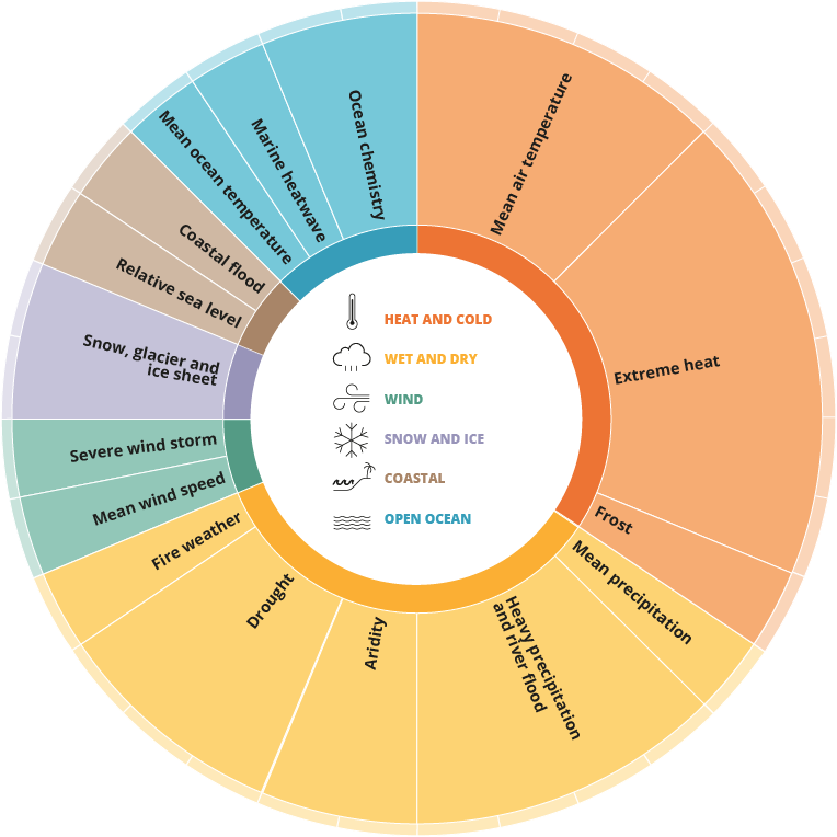
Chapters of the Europe's changing climate hazards report
For references, please go to https://www.eea.europa.eu/publications/europes-changing-climate-hazards-1/wet-and-dry-1/wet-and-dry-heavy or scan the QR code.
PDF generated on 17 Sep 2024, 05:16 AM
Engineered by: EEA Web Team
Software updated on 26 September 2023 08:13 from version 23.8.18
Software version: EEA Plone KGS 23.9.14
Document Actions
Share with others