All official European Union website addresses are in the europa.eu domain.
See all EU institutions and bodiesAn official website of the European Union | How do you know?
Environmental information systems
EN
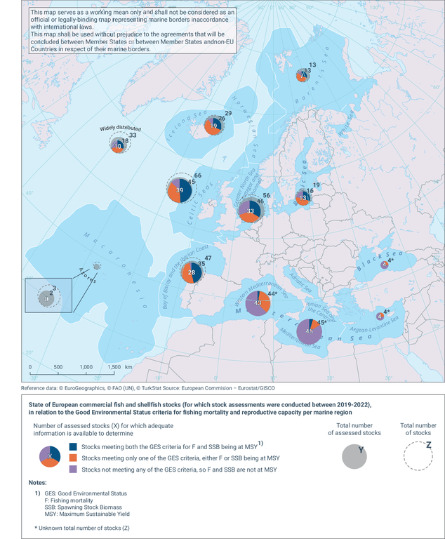
This figure shows the state of the assessed commercially exploited fish and shellfish stocks per European marine region, for which assessments were conducted in 2019-2022. Stocks for which adequate information is available to determine Good Environmental Status (GES) for fishing mortality (F) and/or reproductive capacity (spawning stock biomass (SSB)) are included (i.e. Z, total number of stocks; Y, total number of assessed stocks; and X, number of stocks for which adequate information is available to determine GES on the basis of these two criteria). A distinction is made between stocks: (1) in good status based on both fishing mortality and reproductive capacity; (2) in good status based on only one of the criteria - fishing mortality or reproductive capacity (either because one of the two criteria is not in good status or because there is only one available criteria, and it is in good status); and (3) not in good status based on both fishing mortality and reproductive capacity (may include cases where only one criteria is available and it is not in good status).
Loading