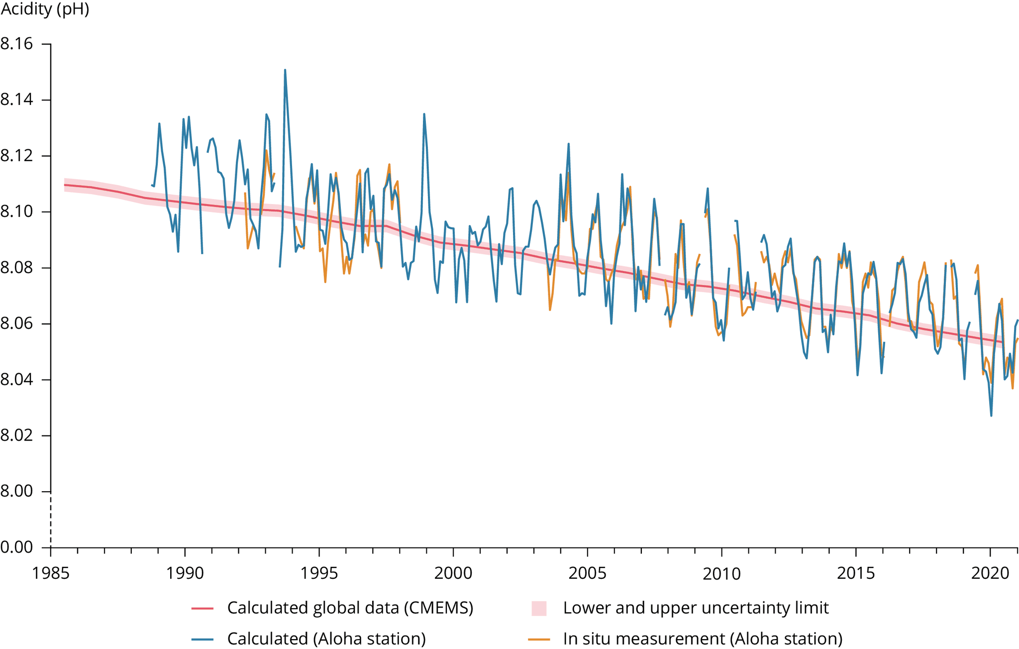
i. Data originate from the Aloha station pH time series (adapted from Dore, J.E., et al., 2009, 'Physical and biogeochemical modulation of ocean acidification in the central North Pacific', Proceedings of the National Academy of Sciences of the United States of America 106:12235-12240).
Changes here are similar to those that are observed over a shorter time frame in Europe (see here: http://www.climatechange2013.org/images/figures/WGI_AR5_Fig3-18.jpg).
* phMeas_insitu – data based on in-situ measurements
* pHcalc_insitu - calculated data
ii. Copernicus Marine Services data: the indicator is available at the annual resolution, and from the year 1985 onwards. The error on each yearly value varies, and is added in the data file sheet. The estimated yearly uncertainty envelope shown in the figure is defined as the annual mean of pH ± 2*the standard deviation, which corresponds to a 95% confidence interval of the mean estimate.


Document Actions
Share with others