Having established that the Agency, at least in the short term, wishes to have a surveillance type-monitoring network then there are a number of options on how this can be developed. These would include:
- Use of current national classification schemes. A number of Member States that have their own general quality assessment schemes or classifications reflecting local national contamination levels/quality using national class limiting thresholds or rating values. These are often based on different indicator determinants, ed in all EEA States.
Option 3 above is considered to be the best option in terms of cost-effectiveness and feasibility.
Stratification serves three purposes.
The following sections outline how this approach has been used in the design of the networks.
At the broadest level inland freshwater can be categorised into three broad types, lakes, rivers and groundwater. In reality there would be different sub-types, for example, for rivers (headwaters, canals, lowland rivers) that would share certain physical, chemical and biological attributes or characteristics. The simplest level of network design would aim representatively to sample and characterise all these different types of inland waters. To do this fairly and comparably all water bodies must be representatively sub-sampled, both nationally and on a Europe-wide basis.
These assessments would result in such statements as "over the last 5 years on average x percent of river sites have shown a y % decrease in nutrient levels". Such a broad assessment would entail the comparison of a very wide range of determinant levels over a wide geographic area and different water types. This type of assessment could then be related to general statements about the implementation of European policies that might have been responsible for the change but it might be more difficult to make more specific statements about human activities in regions or catchments. Trends could be followed and relative hot-spots identified. It would also require that all water types are representatively sampled and quantified, for example headwaters, or that the number of sites used in the assessment relates to the variability of the system and determinant being monitored.
Often a statistical population (for example all rivers in Europe) can be subdivided into more homogenous sub-populations (for example, in the case of rivers, all small, high altitude streams) and random site allocation can be applied to each sub-population separately. This is stratified random sampling, and it is the single most powerful sampling design that can be used. Stratified sampling is almost always more precise than simple random sampling. In stratified sampling the statistical population of N units is divided into sub-populations which do not overlap and which together constitute the entire population. The sub-populations are called strata by statisticians.
To obtain the full benefit from stratification you must know the sizes of all the strata. In many ecological examples stratification is done on the basis of geographic area. It is not necessary to sample each stratum randomly and one could, for example, sample systematically within a stratum - however, it would be difficult to estimate how reliable such sampling is. Confidence intervals can be narrowed appreciably when strata are chosen well and precision is gained when relatively homogenous strata are selected. The critical factor is always to choose strata that are relatively homogeneous in relation to the differences between strata.
The allocation of site numbers in stratified sampling can be determined using proportional or optimal allocation. In proportional allocation sites are allocated to strata on the basis of a constant sampling fraction in each stratum. To use optimal allocation you need to have rough estimates of the variances in each of the strata and the cost of sampling each stratum. Optimal allocation is more precise than proportional allocation and is to be preferred. Cochran (1977) has shown that with optimal allocation the theoretical expectation is that:
Standard error (SE) (optimal) < SE (proportional) < SE (random).
There are three useful rules of thumb in stratified sampling (Krebs 1989). Take a larger sample (number of sites) if;
- The stratum is larger;
- The stratum is more variable internally;
- Sampling is cheaper in the stratum.
It is also understood that the desire is to obtain an overview of the general quality of water resources of the EEA area in relation to human activities. Another option is, therefore, to stratify the sample sites and water types to reflect spatial differences in the potential causal activities impacting water resources and the differences in the inherent variability of water types and determinants. Potentially this would have the additional benefit of reducing the amount of variability within the sample data and hence make the network more cost effective in terms of monitoring costs. However, precise definitions and rules would be required to identify the different strata and the additional supportive and interpretative information to the selected appropriate water determinants. This supportive information (for example, stream order, catchment altitude, population density, land-use) would also need to be collected and presented in standardised ways, and this would be difficult to achieve technically in some countries in the short term.
The random selection of sites within strata will also be desirable even if it is from the sites currently being monitored by regional-water-authority-types organisations. The sites could also be randomly selected each year or reporting period, although this may not be so important. To make the network better, sub-strata need to be defined within each stratum to ensure that the sites selected are not over-representative of certain water types (e.g. if the local monitoring is only of dirty waters). These sub-strata could, for example, be defined as clean, medium or dirty sites; rural, suburban and urban sites; etc. (each in proportion to their relative abundance).
The number of sites should reflect the variability within regions or of certain water body types. The numbers should be based on the inter-site variability within the strata (i.e. intra-stratum variability), the required precision and confidence with which differences are to be detected, and the budgeted costs of the network. If the numbers of sites is determined for several determinants together, then the numbers should be calculated based on the most variable and/or important determinant.
Temporal comparisons are harder because there are less opportunities to get temporally different sampling occasions (there could only be 3 to 5 years per reporting period). However, the optimal numbers of sampling occasions could be calculated using temporal variability (say month-to-month variability) within sites within strata.
The accuracy of any statistic summarising the quality in each stratum is also affected by certain types of variability in the data. However the variability which affects the accuracy is often different from that affecting the precision. Systematic variation such as biases due to measurement techniques or unaccounted-for seasonal variation cause estimates to be inaccurate. If steps are not taken to reduce or remove inaccuracies then there will always be the danger that comparisons made using these data will fail to detect differences which are really there because the biases mask them, or, conversely, report differences which are only due to the biases.
Biases can also creep into the comparison of statistics which will be made between different parts of the European area. These biases are systematic variations in the measures of water quality which would be there whether or not there was any interference on the part of man. For example, differences in catchment altitudes, stream orders, geological make-up and climate all have bearings on the natural state of water bodies. In order that when comparisons are made they are not affected by this sort of bias, it is proposed that the water bodies in a member state be split up into separate categories (termed strata). The strata would be chosen so that the rivers they contain display similar characteristics, such as those mentioned in the previous example. Comparisons of one Member State with another could then be done on a by-stratum basis, thereby only comparing rivers which should be roughly the same. If the sampling stations in each stratum are chosen randomly then aggregating their data will produce a fair indication of the state of the rivers in that stratum.
7.3.1 Numbers of sampling stations for quality status
As an example of the way in which the numbers of sampling stations may be specified consider the following. Suppose that it is required to be able to detect a difference between stratum means of size d with 95% confidence. The number of sampling stations within each stratum (assuming Normality of the mean) is given by
 ,
,
where  is the upper point of the Standard Normal distribution for two-sided tests, and
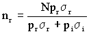
  is the variance within the stratum. Assume that sampling stations are either reference or impact (not both) and their respective numbers are nr and ni, so that N = nr + ni. The optimal allocation of the total number of stations in the stratum, N, between reference and impact is given by,
 ,
,
where pr is the proportion of the stratums total river length which can be counted as being of reference quality, and pi = 1 - pr.
The minimum detectable difference between the mean of the reference stations and the mean of the impact stations, with 95% confidence, will be
 .
.
The above example is one way of deciding on the numbers of sampling stations used to report quality. Different objectives for the reporting will result in different formulae for the numbers of sampling stations.
7.3.2 Numbers of sites for inter-strata comparisons
Comparisons between strata will involve the combination of the site statistics to make stratum summary statistics. For example, the overall stratum mean would be the mean of the individual site means from within the stratum. The number of sites within each regional strata (nr) for inter-strata comparisons is given by,

where  is the intra-stratum variability (i.e. the variability of the stratum site statistics). This is ensuring a certain level of precision and confidence within each stratum. More sites will need to be sampled in regions with greater variability.
7.4 Ecological quality network
The proposed EC Directive on ecological quality of water (COM(93) 680 final) is a major new approach, focusing for the first time on protecting the aquatic ecosystem and water uses as a whole. The proposal is concerned with the adoption of measures to protect all surface waters (lakes, rivers, canals, estuaries and territorial waters) from both point and diffuse source pollution and other anthropogenic influences. The measures adopted must be designed to maintain and improve the ecological quality of waters, with the ultimate aim of achieving good ecological quality.
The main requirements of the proposal are to:
- Set up and introduce monitoring and classification schemes for determining the ecological quality of surface waters;
- Create inventories of point and diffuse pollution sources and undertake assessments of those sources;
- Define operational targets, in terms of good ecological quality, for all surface waters;
- Draw up and implement integrated programmes aimed at achieving the operational targets;
- Inform the public about the outcome of the above initiatives, including consultation over the improvement programmes, and to report on implementation to the Commission.
At least two aspects of the proposal, the monitoring requirements and inventories of point and diffuse sources of pollution, will be of interest and relevance to the Agency. Once established the national monitoring programmes required for this proposed directive will be a major source of information for the Agency. The monitoring will aim to cover a representative sample of the different water types and ecotypes found nationally and across Europe. The selection of reference sites, or reference conditions, indicative of high ecological quality will be crucial to the validity of the quality assessments made under the directive. There are, therefore, common themes between the EEAs network and the ecological directives monitoring requirements.


Document Actions
Share with others