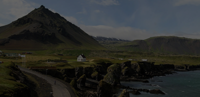
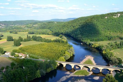
Case study: Assessing time series of forest cover dynamics in Romania
A discrepancy of 500,000 ha in forest area in Romania was found when comparing national legal forest maps and National Forest Inventory information. This case study describes how Romania has set up a multi-data integration system to more accurately assess time series of forest cover dynamics.
The primary challenge arises from Romania's significant discrepancies in forest definitions.
The legal forest boundary is defined by forests included in the national management plan. Forests covered by the plans are subject to strict silvicultural norms and legislation. This information is based on’ precise mapping and regular updates, with forest districts reporting forest conversions annually. The actual extent of forests in Romania according to this dataset is 6.5 Mha.
The National Forest Inventory (NFI) applies a different definition of forests, based on vegetation found at the sampling site. The first cycle in identified a forest area of roughly 7 Mha - resulting in a difference of about 500,000 hectares.
The NFI approach can be considered a robust estimate of the existence of forest at a certain site. However, the NFI is a statistical measurement. It consists of two statistical sampling grids, one of 500x500 meters where for each point, forest vegetation is evaluated by photointerpretation on orthophoto maps, and a 4x4 km sampling grid where forestland category is evaluated on the ground. Thus, the final values of the forest consist of the initial forest vegetation evaluation, which is weighted by the field measurements. It also faces limitations in evaluating forest areas under conversion due to its sampling grid and due to its only two points in time sampling (i.e., 2012 and 2017).
A paradigm shift: from statistical reporting to a geographical approach
To overcome these discrepancies, Romania's GHGI in the LULUCF sector needs substantial improvements. These include transitioning to a spatially explicit system and enhancing the annual reporting system.
The new national arrangements by government decision with the 2020 inventory submission, delineate the reporting responsibilities among four research institutes, each focusing on distinct aspects like forest, other land use categories, soil, and remote sensing. The new legislation also specifies the data sources, mandating national agencies and data collectors to provide necessary data for LULUCF reporting.
The goals were to create uniform land use data across time series, increase the accuracy of annual changes in forest land use, and align with the IPCC Guidelines and LULUCF regulations.
The challenge was to integrate land use and land cover data available nationally, globally, and regionally and combine datasets with different forest definitions, coverage, precisions, and spatial projections.
The new approach implied creating a 100x100-meter point sampling with national coverage. For each point, data were collected from:
National Datasets: Historical datasets from topographic and military maps (1980, 2018), Forest Maps from forest districts (1990 onwards), the Land Parcel Identification System (LPIS)/Integrated Administration and Control System (IACS) (from 2007 onwards); LC maps from orthophoto maps (2006), and
Global/Regional Products as Corine Land Cover (CLC) products (1990 onwards), Copernicus products (Forest Type 2015, 2018), Urban Atlas (2020),
Global datasets, including high resolution global for 2000-2020 period, Eastern Europe's for 1985-2012, and forest disturbance regimes of for 1986-2016.
Further layers were used to improve the classification and identify misclassification errors such as Digital Terrain Model, distance to roads, urban areas and forest edge, and forest height
Time series analysis of forest cover dynamics
The data was used to track changes in forest cover over time at the sampled points to identify stable forests, afforestation, and deforestation patterns. This analysis involved the following key steps:
Initial classification, based on evaluating the presence or absence of forest cover in the time series.
Reclassification and refinement to correct false positives and negatives by considering temporal continuity, spatial patterns, and the influence of neighbouring points to enhance the identification and correction of misclassifications.
Definition of a hierarchy to prioritize the dataset and asses the likelihood based on specific criteria of classification errors in isolated instances (e.g., distinguishing land conversion from georeferencing errors on forest margins) and also include contextual factors such as proximity to urban areas, roads, forest margins, to assess the classification.
Validation of sampling points by manually classifying and correcting classification errors.
Further layers were used to improve the classification and identify misclassification errors such as Digital Terrain Model, distance to roads, urban areas and forest edge, and forest height
The method produces forest classes for each period. Additionally, it provides information about potential forest degradation areas, where forest cover was lost following the restitution process, and regeneration is delayed due to improperly applied silvicultural practices. It can also help to spatially track large-scale phenomena of natural disturbances and offer information about land potentially available for afforestation.
The system limitations and future development needs
The temporal resolution of the approach is constrained by the spatial products used. Moreover, it relies on information taken at intervals of several years and requires interpolation to assess forest areas annually.
The approach might therefore overlook critical dynamics, particularly rapid or short-term changes in land cover. Furthermore, the method for classifying and reclassifying forest cover is based on expert-driven criteria (hierarchy of datasets) and involves manual validation steps. This may cause errors and requires efforts for identifying and correcting misclassifications. The system's capacity to identify and measure forest conversion in recent years relies on the availability of accurate land use maps for validation, distinguishing between forest degradation, forest cover loss due to harvesting, and deforestation. The system tends to overestimate areas of forest conversion. This can be considered a conservative approach for reporting deforestation. However, it requires extra efforts for identifying afforestation areas.
Iceland still lacks country specific data for applying higher tier methodologies and approaches, especially for grasslands, croplands and wetlands. A case study presents how the country established an “improvement group” for advancing GHG reporting.
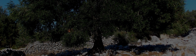
Moving to higher tiers often requires moving from default emissions factors and parameters, using more relevant values from national or regional studies. This case study presents how a regional project covering European Mediterranean countries developed information on carbon stocks and fluxes for living biomass in cropland and grasslands to improve the LULUCF monitoring in this region with specific ecological conditions.
Croatia needed to develop a geographically-explicit approach for land monitoring. This case study presents a LIFE-funded project that is aimed at creating such approach, using different earth observation products. The creation of a national land-use change timeseries has many policy implications for Croatia.
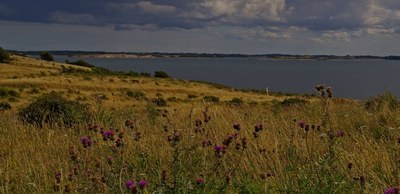
According to UNFCCC rules, LULUCF reporting from grassland and cropland should include the impact of trees and other woody vegetation . Trees on agricultural land in the EU have significant biomass production, which is not consistently recorded in the GHG inventories of Member States. Nor are Trees outside forests consistently reported in the GHG inventories of Member States.
Environmental policies are often based on a benchmark: maximum level of pollution allowed threshold above which further action is subsidized, etc. Improving the local relevance of the benchmark increases the cost-efficiency of a policy. Denmark has already applied this rationale to two environmental policies: peatland rewetting and nitrogen limits.
Like many countries, Canada was confronted with the challenges of timely reporting and the combining of multiple datasets for estimating forest emissions and removals. To address these challenges, Canada developed the Carbon Budget Model of the Canadian Forest Sector (CBM-CFS3) . It is a complex Tier 3 model that can be used for other purposes and by other stakeholders (e.g. projections, harvest strategy, fire prevention).
As many countries, France has an efficient forest inventory which provides accurate estimates of tree growth, harvest and mortality. The associated drawback is a coarse time resolution which hinders appropriation of the reported data by policy makers. To bridge this gap, a simple model combining 5-yearly forest inventory data with annual statistics was developed , allowing meaningful annual estimates which, among others, reflect dramatic events such as storms in the time series.
Over the past few years in France, farmers have received incentives to define the GHG budget of their farm and identify climate mitigation levers through numerous channels. However, the synergies with the national GHG inventory and public policies are still underexploited.
Portugal has developed its own land use and land-use change map that is a good example of a geographically-explicit approach to monitoring areas for the LULUCF inventory with a temporal consistency. This case study also presents Portugal’s method to cover past periods.
This case study presents how France implemented a new geographically-explicit method to move from Approach 2 to Approach 3 for land representation. This method combines several national and European datasets within a high-resolution grid, using hierarchy rules and correspondence between nomenclatures.
To visualize priority areas for the LULUCF monitoring and mitigation actions, various environmental geospatial products are available from national, European or international products. In this case study, we present Italy’s national portal that displays such maps.
Agricultural use of organic soils contributes substantially to GHG emissions from organic soils. The Austrian Environment Agency addresses these questions in a project aiming to improve the estimates of drained organic soils in the Austrian National GHG Inventory
Ireland has experienced a fast evolution of methodology of the reporting of GHGs from grassland and wetlands that was influenced by a close collaboration between the communities of GHG reporting and research. A basis for this is the involvement of GHG inventory staff members in research projects as discussed by this case study.
Iceland still lacks country specific data for applying higher tier methodologies and approaches, especially for grasslands, croplands and wetlands. A case study presents how the country established an “improvement group” for advancing GHG reporting.
Moving to higher tiers often requires moving from default emissions factors and parameters, using more relevant values from national or regional studies. This case study presents how a regional project covering European Mediterranean countries developed information on carbon stocks and fluxes for living biomass in cropland and grasslands to improve the LULUCF monitoring in this region with specific ecological conditions.
Croatia needed to develop a geographically-explicit approach for land monitoring. This case study presents a LIFE-funded project that is aimed at creating such approach, using different earth observation products. The creation of a national land-use change timeseries has many policy implications for Croatia.