All official European Union website addresses are in the europa.eu domain.
See all EU institutions and bodiesAn official website of the European Union | How do you know?
Environmental information systems
EN
Ireland has experienced a fast evolution of methodology of the reporting of GHGs from grassland and wetlands that was influenced by a close collaboration between the communities of GHG reporting and research. A basis for this is the involvement of GHG inventory staff members in research projects as discussed by this case study.
Bridging between research and reporting communities
According to its NIR, Ireland’s LULUCF sector is a net source of emissions in all reporting years. The net balance is dominated by the impact of drainage of organic soils in grasslands and wetlands. Despite the large share of these land categories, Ireland has (up until 2024 inventory submission) applied Tier 1 methodologies due to a lack of country specific data. In 2023 two peer reviewed publications provided significant updates to the methodologies employed for grasslands on organic soils and wetlands. Close collaboration between the inventory agency (the Irish Environmental Protection Agency, EPA) and the research community in Ireland (e.g. Universities, and the Irish Agriculture and Food Development Authority (Teagasc)) is currently and will continue to lead to significant improvements in the LULUCF inventory going forward.
A basis for the close collaboration is the involvement of GHG inventory staff members in research project steering committees. This is enabled by the rather small communities involved in agriculture and land use research in Ireland. However, another important factor is that topics of GHG inventory improvement actively drive the agenda of scientific work at academic and other research organisations. Good knowledge and understanding of the IPCC reporting guidelines among researchers is another supporting element of successful collaboration in Ireland.
For identification and better coordination of research needs EPA and the Department of Agriculture, Food and the Marine have set up an inventory improvement group. The group meets on several occasions during the year to discuss issues around GHG inventory improvements for both the agriculture and the LULUCF sectors and involves additional experts where required depending on the topic to be discussed.
Improving reporting by setting national research priorities
According to its NIR, Ireland’s LULUCF sector is a net source of emissions in all reporting years. The net balance is dominated by the impact of drainage of organic soils in grasslands and wetlands. Despite the large share of these land categories, Ireland has (up until 2024 inventory submission) applied Tier 1 methodologies due to a lack of country specific data. In 2023 two peer reviewed publications provided significant updates to the methodologies employed for grasslands on organic soils and wetlands. Close collaboration between the inventory agency (the Irish Environmental Protection Agency, EPA) and the research community in Ireland (e.g. Universities, and the Irish Agriculture and Food Development Authority (Teagasc)) is currently and will continue to lead to significant improvements in the LULUCF inventory going forward.
The nutrient and drainage status of grasslands on organic soils is another field of research that directly feeds into GHG reporting.
- How relevant such targeted research projects are for advancing GHG reporting was demonstrated by two scientific articles published in 2023 (Aitova et al. 2022; Tuohy et al. 2023) that led to significant recalculations in relation to emissions from organic soils (in both the grasslands and wetlands categories) in Ireland.
- The publications provided a review of recently unearthed historic information of the drainage status of grasslands on organic soils and meta-analysis of national research undertaken on peatlands.
- This helped establishing country specific emission factors based on nutrient and drainage status of organic soils. For grasslands, total emissions were reported to be on average 3.6 Mt CO2eq (-53%) lower across the timeseries 1990-2021. This study has led to the development of further work in this area (DAFM Research funding 202330).
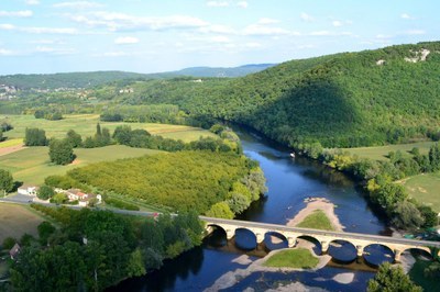
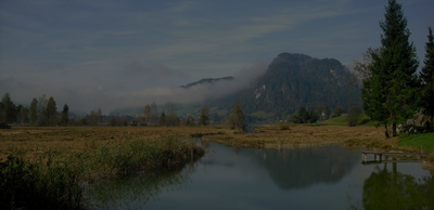
Peatlands
Wetlands is the second largest land-use category in Ireland, accounting for more than 17% of the land area. The EPA has recently established three research fellows that are investigating conditions for GHG emissions and removals from peatlands in Ireland for CO2, CH4 and N2O under the EU-LIFE program31.
Bord Na Mona, the Irish Peat Bord, a semi state commercial company, has since 2021 undertaken a large-scale peatland rewetting and restoration program on 33.000 ha of exploited peatland, which will be completed by mid-202632. Data on the extent of activities is being collated and will be incorporated along with relevant research studies to assess these actions as they occur in future inventory submissions.
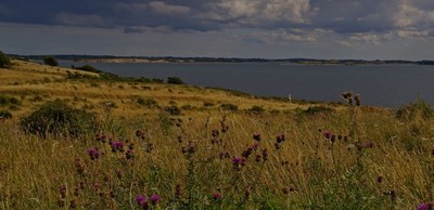
Grasslands and soils
The scientific understanding of emissions and removals from grassland on both mineral and organic soils will be enhanced even more in the future. Recently, the Irish Department of Agriculture, Food and the Marine has funded the National Agricultural Soil Carbon Observatory (NASCO).
- 28 eddy covariance flux towers will provide measurements of gas exchange between soil, vegetation and the atmosphere.
- The results collected by NASCO will be used to further constrain estimates of GHG emissions and removals and understand underlying processes.
- The use of such data sources requires also modelling tools and capacities for running them to integrate the information into GHG inventories.
On the importance of long-term research for improved GHG inventory information
Mutual understanding of the needs and constraints is important for successful collaboration between science and GHG reporting communities. For example, for reporting of GHG emissions and removals from soils with reasonable accuracy, research needs to produce multi-year and multi-site data covering a range of environmental conditions and treatments.
Also advancing GHG reporting by moving towards more use of spatially explicit data requires multi-year research efforts. The integration process towards a new system of land use mapping in Ireland for reporting under the LULUCF Regulation is a multi-year project that is currently underway and will take a number of years to complete with significant human and monetary resources involved.
An important aspect of research planning regarding the integration of spatially explicit information into GHG reporting is the consideration of opportunities for the reuse of data going forward. Multi-purpose maps require that during the process of map combination and intersecting as many attributes as possible are being included. While a low number of attributes in map integration decreases computation time and costs, a higher number makes map products relevant for more potential users and alternative applications. Such considerations are crucial for planning of GHG improvements as later inclusion of additional attributes is often challenging.
Other case studies

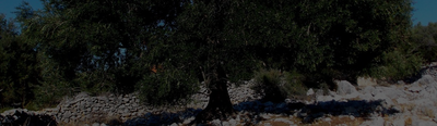

According to UNFCCC rules, LULUCF reporting from grassland and cropland should include the impact of trees and other woody vegetation . Trees on agricultural land in the EU have significant biomass production, which is not consistently recorded in the GHG inventories of Member States. Nor are Trees outside forests consistently reported in the GHG inventories of Member States.
Environmental policies are often based on a benchmark: maximum level of pollution allowed threshold above which further action is subsidized, etc. Improving the local relevance of the benchmark increases the cost-efficiency of a policy. Denmark has already applied this rationale to two environmental policies: peatland rewetting and nitrogen limits.

Like many countries, Canada was confronted with the challenges of timely reporting and the combining of multiple datasets for estimating forest emissions and removals. To address these challenges, Canada developed the Carbon Budget Model of the Canadian Forest Sector (CBM-CFS3) . It is a complex Tier 3 model that can be used for other purposes and by other stakeholders (e.g. projections, harvest strategy, fire prevention).