Case study: Iceland’s improvement group: institutional arrangements for advancing GHG reporting
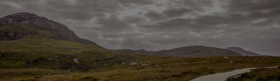
Iceland still lacks country specific data for applying higher tier methodologies and approaches, especially for grasslands, croplands and wetlands. A case study presents how the country established an “improvement group” for advancing GHG reporting.
Iceland still lacks country specific data for applying higher tier methodologies and approaches, especially for grasslands, croplands and wetlands. One concrete example is country specific stock change factors for organic soils. In the past, a strong focus has been placed on improving data availability for forestry and revegetation being mandatory and elected activities under the Kyoto protocol.
In 2021 the Ministry of Environment, Energy and Climate requested improvements and together with the Ministry of Food, Agriculture and Fisheries, gave the mandate to the two former institutions, the Soil Conservation Service of Iceland and the Icelandic Forest Service from 2024 merged together in Land and Forest Iceland, to carry out work for improving the national GHG inventory. Dedicated staff from the four institutions came together and formed “the improvement group”.
Key features of the group’s working mode include:
Work plans are established for three-year periods. Work plans are built around data needs and how these will be fulfilled. The source for identifying areas of improvements are the table of key categories and comments received by the technical expert review. The first work plan was concluded in 2023, the next will conclude in 2026.
Work plans contain a limited number of specific projects, with clearly defined outputs and required resources. The projects may address data collection from existing sources or set up new processes for generating data. Each institution has its assigned projects.
Progress on these projects is tracked and there is annual status reporting.
The group meets regularly. Experience showed that four to eight times a year is an adequate meeting frequency.
A key factor for successful implementation of the projects is the availability of dedicated technical staff and assignment of necessary resources.
The group collaborates with universities in projects to carry out modelling and field measurements. It coordinates work and carries out quality control, ensuring that the work carried out and the results fit reporting requirements.
The improvement group has so far been successful because it brings together decision makers in the ministries and technical experts in the agencies.
This allows not only identifying and prioritizing required improvements, but also discussing the implications of methodological changes.
The group also facilitates a meaningful exchange about which improvements are possible and which not as well as about required resources for implementation.
The involvement of all relevant stakeholders in the improvement process ensures that all are committed to implementing the agreed changes. Iceland’s experience shows, the importance of having decision makers from the ministries involved in the process from early on.
Advancing GHG reporting and projections under the LULUCF Regulation is the primary driver for the improvement group. However, other data needs also play a role when implementing improvement projects in Iceland. For example, the new soil map, currently under development, will also be used for land use mapping, e.g. for determining suitability of areas for specific uses, creating a soil erosion map and identifying degraded areas. The latter will be used in the context of commitments under the Kunming-Montreal Global Biodiversity Framework, to identify priority areas for restoration.
Needs related to biodiversity will also play a role in the next cycle of the national forest inventory, which will include biodiversity monitoring. Identifying opportunities for the multiple use of data, research results and innovation technics increases the number of potential users and thus can reduce costs, which is another benefit of institutional arrangements like the improvement group founded in Iceland.
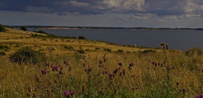
Ireland has experienced a fast evolution of methodology of the reporting of GHGs from grassland and wetlands that was influenced by a close collaboration between the communities of GHG reporting and research. A basis for this is the involvement of GHG inventory staff members in research projects as discussed by this case study.
Moving to higher tiers often requires moving from default emissions factors and parameters, using more relevant values from national or regional studies. This case study presents how a regional project covering European Mediterranean countries developed information on carbon stocks and fluxes for living biomass in cropland and grasslands to improve the LULUCF monitoring in this region with specific ecological conditions.
Croatia needed to develop a geographically-explicit approach for land monitoring. This case study presents a LIFE-funded project that is aimed at creating such approach, using different earth observation products. The creation of a national land-use change timeseries has many policy implications for Croatia.
According to UNFCCC rules, LULUCF reporting from grassland and cropland should include the impact of trees and other woody vegetation . Trees on agricultural land in the EU have significant biomass production, which is not consistently recorded in the GHG inventories of Member States. Nor are Trees outside forests consistently reported in the GHG inventories of Member States.
Environmental policies are often based on a benchmark: maximum level of pollution allowed threshold above which further action is subsidized, etc. Improving the local relevance of the benchmark increases the cost-efficiency of a policy. Denmark has already applied this rationale to two environmental policies: peatland rewetting and nitrogen limits.
Like many countries, Canada was confronted with the challenges of timely reporting and the combining of multiple datasets for estimating forest emissions and removals. To address these challenges, Canada developed the Carbon Budget Model of the Canadian Forest Sector (CBM-CFS3) . It is a complex Tier 3 model that can be used for other purposes and by other stakeholders (e.g. projections, harvest strategy, fire prevention).
As many countries, France has an efficient forest inventory which provides accurate estimates of tree growth, harvest and mortality. The associated drawback is a coarse time resolution which hinders appropriation of the reported data by policy makers. To bridge this gap, a simple model combining 5-yearly forest inventory data with annual statistics was developed , allowing meaningful annual estimates which, among others, reflect dramatic events such as storms in the time series.
Over the past few years in France, farmers have received incentives to define the GHG budget of their farm and identify climate mitigation levers through numerous channels. However, the synergies with the national GHG inventory and public policies are still underexploited.
A discrepancy of 500,000 ha in forest area in Romania was found when comparing national legal forest maps and National Forest Inventory information. This case study describes how Romania has set up a multi-data integration system to more accurately assess time series of forest cover dynamics.
Portugal has developed its own land use and land-use change map that is a good example of a geographically-explicit approach to monitoring areas for the LULUCF inventory with a temporal consistency. This case study also presents Portugal’s method to cover past periods.
This case study presents how France implemented a new geographically-explicit method to move from Approach 2 to Approach 3 for land representation. This method combines several national and European datasets within a high-resolution grid, using hierarchy rules and correspondence between nomenclatures.
To visualize priority areas for the LULUCF monitoring and mitigation actions, various environmental geospatial products are available from national, European or international products. In this case study, we present Italy’s national portal that displays such maps.
Agricultural use of organic soils contributes substantially to GHG emissions from organic soils. The Austrian Environment Agency addresses these questions in a project aiming to improve the estimates of drained organic soils in the Austrian National GHG Inventory
Ireland has experienced a fast evolution of methodology of the reporting of GHGs from grassland and wetlands that was influenced by a close collaboration between the communities of GHG reporting and research. A basis for this is the involvement of GHG inventory staff members in research projects as discussed by this case study.
Moving to higher tiers often requires moving from default emissions factors and parameters, using more relevant values from national or regional studies. This case study presents how a regional project covering European Mediterranean countries developed information on carbon stocks and fluxes for living biomass in cropland and grasslands to improve the LULUCF monitoring in this region with specific ecological conditions.
Croatia needed to develop a geographically-explicit approach for land monitoring. This case study presents a LIFE-funded project that is aimed at creating such approach, using different earth observation products. The creation of a national land-use change timeseries has many policy implications for Croatia.