All official European Union website addresses are in the europa.eu domain.
See all EU institutions and bodies
An official website of the European Union | How do you know?
Environmental information systems
EN


From farmland to forests, scrubland and waterways, a new video released by the European Environment Agency (EEA) today highlights the unique diversity of Europe’s landscapes and the challenges they face. With use of data from the Copernicus Land Monitoring Service, it draws attention to how Europe can make more space for a healthy and resilient nature, which can significantly help reduce climate change impacts.
From Sweden to Spain, Daniel Raven-Ellison, a UK-based citizen geographer trekked across 12 European countries over a three-week period earlier this year to film the video produced by EEA's Copernicus Land Monitoring Service.
One second = 1%
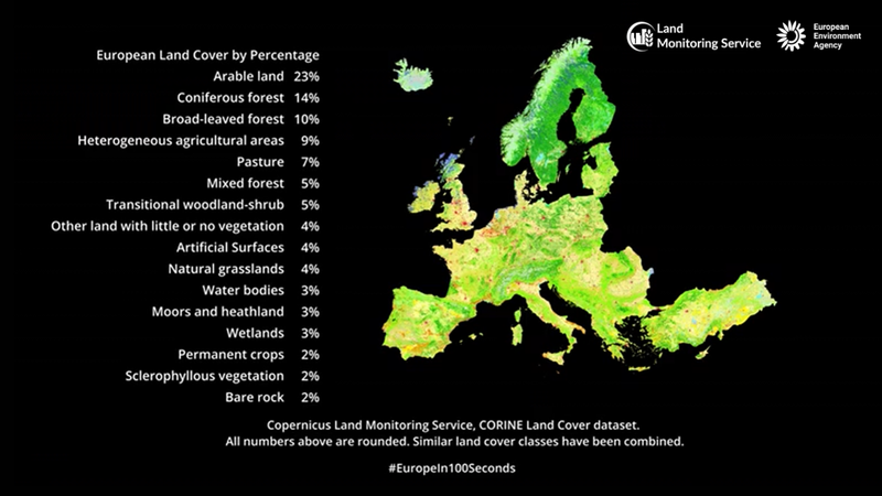
Each second of the 100-second walk represents one percent of Europe’s land and how it looks like from above with the use of land cover data from the EU’s Copernicus Earth observation and monitoring programme.
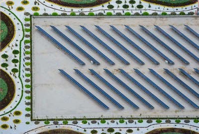
Landscapes covered include built-up areas like buildings and roads, wetlands, inland waterways, scrub and grasslands and forests. The largest chunk of land cover in Europe is taken up by farmland, including patchworks of fields, livestock pastures and larger crop fields.
The aim of the video is to raise public awareness of what their surrounding landscapes are used for and how much space is allotted to wilderness and nature.
This video gives a unique and new perspective on our many different and valued landscapes which many people may not be aware of. At the same time it also highlights the value of space for nature, so it can thrive as well as the value of our natural landscapes for our own well-being.

Executive Director European Environment Agency
“As a geography educator I want everyone to be better informed so that we can make better decisions for people, nature and the climate. I wanted to make a film that uses science-based information to reveal how we are really using our land - and to physically show how we can make more space for nature,” said Raven-Ellisson.
Intense land use monitored from above
According to data from the EU’s Copernicus Land Monitoring Service, and more specifically, the CORINE land cover data set, Europe is one of the most intensively used landmasses on the globe, with the highest share of land used for agriculture, followed by forests and, to a lesser extent, urban areas and infrastructure.
The land monitoring service transforms raw satellite imagery and ground sensor data into detailed, ready-to-use datasets on European land cover and land use.
Breakdown of land use in Europe
Changes in how we use our land remains relatively stable over time, except for artificial surfaces like built areas and roads, according to the latest dataset from the Copernicus Land Monitoring Service.
Increased land-take (change in agricultural, forest and other semi-natural land taken for urban and other artificial land development) puts pressure on biodiversity, degrades habitats and contributes to issues such as soil sealing, landscape fragmentation, increased flood risk and urban heat island effects.
Click here to watch the video on our EEA YouTube channel
For more information, check out the Copernicus Land Monitoring Service website.