All official European Union website addresses are in the europa.eu domain.
See all EU institutions and bodiesAn official website of the European Union | How do you know?
Environmental information systems
EN
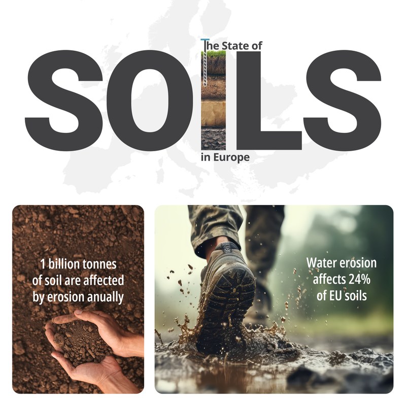
Soil is a vital component of natural capital, hosting rich biodiversity and providing critical ecosystem services, such as food production, water purification and carbon storage. However, the majority of EU soils are considered unhealthy, with potentially 2.8 million sites being contaminated.
Soil is one of the essential components of land, playing a crucial role in nature’s cycles, particularly water and nutrient cycles. Soil is the source of 90% of all food, feed, fibre and fuel production in the EU — and it also provides valuable raw material for the horticulture and construction sectors.
Even a small patch of soil can teem with life, ranging from tiny organisms to fungi and earthworms, all playing a vital role in the functioning of the soil ecosystem. In this space, nutrients are also turned into forms that plants can take up, allowing biomass to form and store carbon. It is here that drinking water starts its natural purification process.
These natural processes are under threat from pollutants released by industry, transport and other economic activities. Unsustainable farming practices, fertilisers and pesticides also contaminate the soil. Eventually, this pollution affects plants, animals and human health. Soil degradation in the EU also comes with an economic cost of more than EUR 50 billion per year.
The way we use soil is also linked to climate change. Soil contains carbon and nitrogen, which can be released into the atmosphere depending on how we use the land. Clearing rainforests for cattle grazing or planting forests can tilt the global greenhouse gas emission balance one way or the other. The melting of permafrost — soil meant to be permanently frozen — due to rising global temperatures can also release greenhouse gases and accelerate temperature rise. Climate change can also substantially alter what European farmers can produce and where.
In the EU, soils are overall a source of greenhouse gas emissions, but through management, it is possible to reduce these emissions and instead enhance the removal of CO2 from the atmosphere.
Press releases and articles
Publications
Indicators
Maps and charts
Datahub
Frequently asked questions
Urgent action needed to reverse soil degradation in Europe
Soil degradation threatens our competitiveness, food security, agricultural productivity, biodiversity, and resilience to extreme weather events and climate change. Joint efforts at EU, national, and local level focus on restoring soil health.
Launched at the EU Soil Observatory Stakeholder Forum, the 2024 State of Soils in Europe report assesses the state of soil degradation across the EU and other countries in the European Economic Area, including Ukraine, Türkiye, and the Western Balkans. The report shows alarming status and trends, with soil degradation getting much worse in recent years, and highlights the need for immediate action to reverse this trend.
The State of Soils in Europe report is a collaboration between the Joint Research Centre and the European Environment Agency.
How can Copernicus help?
The Copernicus Land Monitoring Service offers several free-to-use data products related to soil monitoring. Soil moisture data layers—including Surface Soil Moisture, which provides information on the relative water content of the top few centimeters soil, and the Soil Water Index, which quantifies the moisture condition at various depths in the soil—can be used for applications in agriculture, water management, weather forecasting, ecological modeling, and conservation efforts.
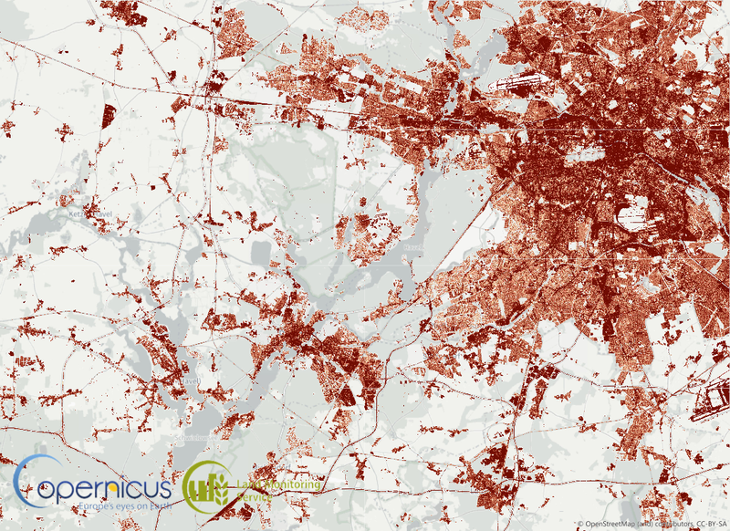
Land cover datasets like the High Resolution Layer Imperviousness, Urban Atlas, and CORINE Land Cover provide comprehensive details on soil sealing throughout Europe.
Maria Pinto, Well with Nature/EEA
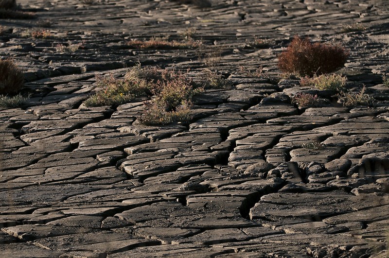
Soil moisture deficit: nature’s warning system
Soil moisture is essential for plant development. It regulates soil temperature, salinity, nutrient availability, and the presence of toxic substances. Soil moisture also gives soil structure, prevents soil erosion, and helps determine land use suitability.
From 2000-2019, soil moisture in the growing season was several times below the long-term average in EEA member countries plus the United Kingdom.
2019 was a particularly difficult year, with over 1.45 million km2 affected by soil moisture deficit. Moisture content was also low in 2012, 2015 and 2018, contributing to increasingly frequent and intense drought pressure.
The soil sealed under roads and pavements
Europe’s urban areas are growing, often at the expense of fertile agricultural land. As a result, concrete and asphalt surfaces can seal soil, preventing it from performing its functions such as storing water, producing food and biomass, regulating climate, buffering harmful chemicals, and providing habitats.
Rain on sealed surfaces also runs off rather than seeping into the soil, where it can be filtered by and can replenish the groundwater.
Rosana Grecchi, Sustainably Yours/EEA