All official European Union website addresses are in the europa.eu domain.
See all EU institutions and bodiesAn official website of the European Union | How do you know?
Environmental information systems
EN
Over a more than 26-year career with the European Environment Agency, Chris Steenmans, the head of the Data and Information Services programme, has played an instrumental role in shaping the trajectory of satellite-based environmental monitoring across Europe. We sat down to talk with him about his remarkable journey — from his early days as a consultant for an experimental land monitoring programme, to becoming a key figure in the Copernicus programme.
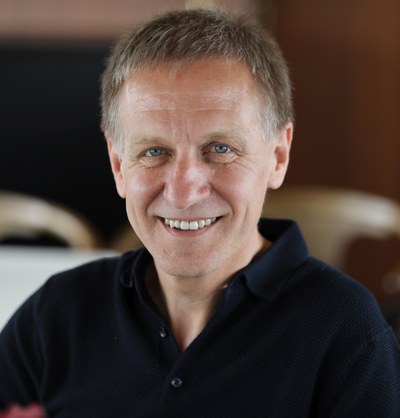
Head of the EEA's Data and Information Services programme
How did you get involved with land monitoring in the first place?
My background is in geoscience. When I specialised, it was in computer cartography and, more specifically, satellite image processing.
In fact, one of my first jobs was as a consultant for an experimental programme called Coordination of Information on the Environment, or CORINE. Its goal was to determine whether it was feasible to do land monitoring with satellite data – a quite novel idea in 1985. This five-year experiment was successful and played a role in the establishment of the European Environment Agency (EEA). The idea was to take care of environmental information and monitoring, together with the countries. Land cover was identified as one of the key topics to pursue and I was recruited to the EEA in 1997.
In 1998, I was invited to a pivotal meeting in Baveno, Italy, to discuss the formation of a new global monitoring programme which ultimately became Global Monitoring for Environment and Security, or GMES. I expressed that this should be a user-driven programme. When you put new instruments and new infrastructure into space, it needs to respond to the demands of the user community. The space community acknowledged the importance of a user focus but struggled how to get the environmental user community on board. Ultimately, I was able to bridge this gap. In 2012, GMES was rebranded as Copernicus, and the Europe-focused part of the Land Monitoring Service was entrusted to the EEA.
Over your career, which key moments stand out?
There are many. A moment where I thought, yes, we are on the right track, was when I got one of the first hand-held mobile devices from Garmin. It had the CORINE land cover dataset as the background for navigation.
Another example would be from the mid-2000s when the impacts of climate change were becoming more visible. One day I received a call from an insurance company interested in identifying highly populated areas in flood plains to recalibrate their flood insurance rates. Non-environment entities were using our data. It was a breakthrough.
There was also the launch of the Sentinel 2A satellite. I was invited, as a user, to provide online comments about why this satellite was important and what it was designed to do, during the live transmission of the launch. It was something that I took great pride in.
How has the Copernicus Land Monitoring Service affected environmental monitoring?
Besides providing timely, consistent data on land cover changes, Copernicus Land Monitoring Service (CLMS) helps us integrate different kinds of datasets. You have all these different types of monitoring... air quality, water, biodiversity... by being able to georeference these measurements through land cover mapping, you can now integrate air quality data, with biodiversity, with socioeconomic data, and so on.
Also, agreeing on standardised land cover definitions was no small feat, as it involved accommodating different perspectives (e.g., statisticians, biophysicists, geographers). But in the end, a set of standardised definitions has emerged and enabled effective satellite-based land monitoring at the continental and global scales.
Still, even today, if you look at forests, every country has its own definition of what a forest is, depending on height, ground cover density, etc. But when it comes to continental and global monitoring, we work together with other organisations like FAO (UN Food and Agriculture Organization) to agree on a standardisation with regards to land information.
What role has technology played over this period?
It has affected everything related to information technology and data processing. For example, if you take the high-resolution monitoring that we started in 2015, AI (artificial intelligence) was very marginal back then. Now, it is part of the standard processing methodology. Without AI, the many terabytes of data that come from the Sentinel satellites and Copernicus supporting missions would be all but impossible to sift through in any meaningful way.
Similarly, in the past, defining the reference training dataset was all done manually. You had to tell the machine: this is an orchard, or this is a forest… Now, thanks to machine learning, the system is self-educating, self-improving, doing contextual analysis and pattern recognition. These are enormous breakthroughs, especially for this kind of space-based monitoring.
What does the decade ahead hold for CLMS?
CLMS needs to continue serving end-users. If we look at what is happening with the climate and the environment, we will need fast support systems to help us make the right decisions. This is what Europe is trying to develop now with ‘Destination Earth,’ where the goal is to create a number of digital twins of an ecosystem, an urban area, a coastal environment and so on, and then feed them with near-real time environmental data. We will then have a virtual environment that can allow for advanced simulations of different scenarios.
For example, we could ask how the air quality in a city will be improved if we increase green urban area by a given percent, and then use a digital twin of that urban area that is being fed near-real time data streams to run a series of simulations. The technology required to create a perfect digital twin of an environment is still in its initial stages but is already revolutionising the field and will continue to do so in the years to come.
Has there ever been a user application that surprised you?
The Ground Motion Service! I knew about the existence of the technology and what you could do with radar images for many years, but I never expected that we would be able to integrate it as part of the Copernicus Land Monitoring Service. The European Ground Motion Service allows users to detect and measure ground movements across Europe with millimetre precision. It has immense potential for monitoring impacts of climate change, ground water changes… As a tool for filling a gap of knowledge that was not previously available, I think it is just fantastic.
What about in situ data?
The EEA is also in charge of coordinating the in situ component of Copernicus, which is made up of all the various on-the-ground sensors distributed throughout Europe and the rest of the world. The legitimacy of the Copernicus programme depends on in situ data. It is indispensable.
When you think of all that goes into the air quality monitoring, water monitoring, biodiversity monitoring, you name it, countries are investing heavily in in situ and that’s where I think, together with Eionet, the EEA will continue to play a key role in making sure these investments can be used as much as possible by the space community for environment and climate monitoring.
What are your plans for the next phase of your life?
After I retire in August 2023, I will definitely keep an eye on everything that is not only coming from space but going into space. When I was a 12-year-old boy, I set up an astronomy club at school with some friends. Astronomy has always been a hobby of mine. In fact, I remember when I was 15, I was writing to NASA and asking if I could have the coordinates of their satellites, because I wanted to know when I could see them appearing in the sky.
It was this love of astronomy and satellites that led me into the field of geoscience and satellite imagery and set the tone for the rest of my professional life. So, I am sure I will pick astronomy back up again. I built my own telescope, and my sister has a big observatory in France. So that is where you might find me, looking up at the sky.
What will you miss most?
The people, without a doubt. I made so many friends over the years — not only here at the agency but also around Europe. My many fantastic colleagues are one of the main things that made this job so enjoyable.

