All official European Union website addresses are in the europa.eu domain.
See all EU institutions and bodiesAn official website of the European Union | How do you know?
Environmental information systems
EN
The figure illustrates the combination of availability and accessibility to areas that offer both green and quiet environments within a 400-meter walking distance from their homes. Distinct patterns emerge across European urban centres, allowing for the identification of five key groups ranging from low to high availability and accessibility of quiet green areas.
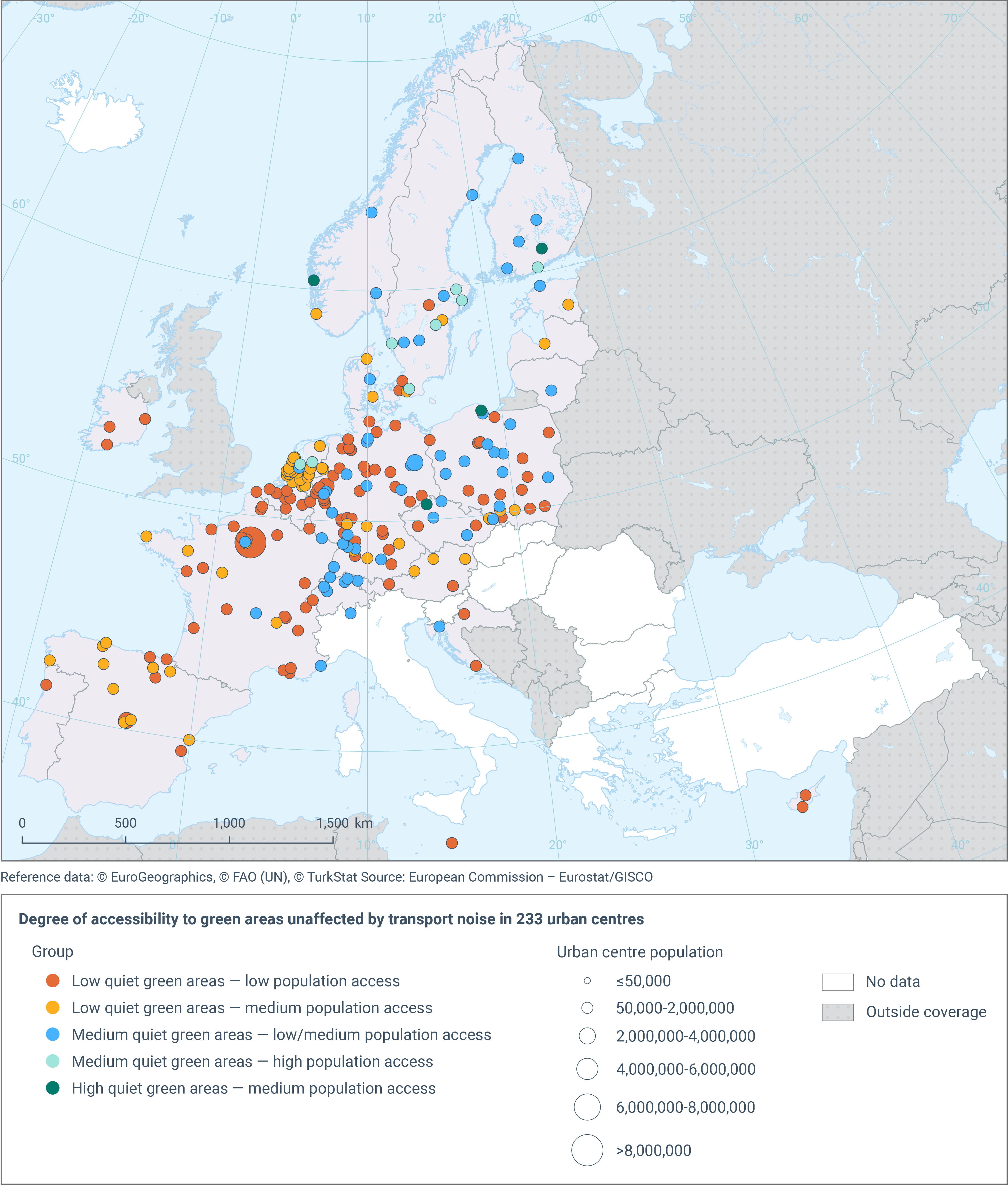
The methodology includes two steps. The first step involves identifying quiet green areas within urban centres by excluding those that intersect road traffic noise contour maps with noise levels equal to or exceeding 55 dB Lden. This step provides an estimate of the maximum potential area of quiet green spaces, based on the assumption that road traffic is the primary source of noise within urban centres. The second step assesses the accessibility of these quiet green areas. This is done by delineating service areas, defined as streets located within 400 meters of the identified quiet green spaces, and calculating the population residing within these service areas.
Colour relates to a combination of low-medium-high levels for both indicators. The size of the points in the figure corresponds to the accessible, quiet green area.