All official European Union website addresses are in the europa.eu domain.
See all EU institutions and bodiesAn official website of the European Union | How do you know?
Environmental information systems
EN
- БългарскиBG
- češtinaCS
- HrvatskiHR
- danskDA
- NederlandsNL
- ελληνικάEL
- EnglishEN
- eestiET
- SuomiFI
- FrançaisFR
- DeutschDE
- magyarHU
- ÍslenskaIS
- italianoIT
- LatviešuLV
- lietuviųLT
- MaltiMT
- NorskNO
- polskiPL
- PortuguêsPT
- RomânăRO
- slovenčinaSK
- SlovenščinaSL
- EspañolES
- SvenskaSV
- TürkçeTR
Valais forest state for lower elevation areas
Chart (static)
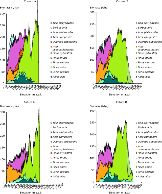
Forest state (biomass) as simulated by the forest model LandCLim, across two elevation gradients in the Valais, Switzerland

Downloads
Data sources
Metadata
More info
Loading
- Switzerland
1900-2000
2098
Methodology
The spatially explicit forest simulation model LandClim was used to simulate the state of the forest in the Valais, Switzerland (Schumacher, S., H. Bugmann, and D. J. Mladenoff. 2004. Improving the formulation of tree growth and succession in a spatially explicit landscape model. Ecological Modelling 180:175-194.). The simulation was run for two districts in the Valais: the main section of the Rhone valley near Visp, and the lower section of the Saas Valley.