All official European Union website addresses are in the europa.eu domain.
See all EU institutions and bodiesAn official website of the European Union | How do you know?
Environmental information systems
EN
- БългарскиBG
- češtinaCS
- HrvatskiHR
- danskDA
- NederlandsNL
- ελληνικάEL
- EnglishEN
- eestiET
- SuomiFI
- FrançaisFR
- DeutschDE
- magyarHU
- ÍslenskaIS
- italianoIT
- LatviešuLV
- lietuviųLT
- MaltiMT
- NorskNO
- polskiPL
- PortuguêsPT
- RomânăRO
- slovenčinaSK
- SlovenščinaSL
- EspañolES
- SvenskaSV
- TürkçeTR
Road distance to nearest motorway or major road on base of LAU2-units (municipalities)
Map (static)
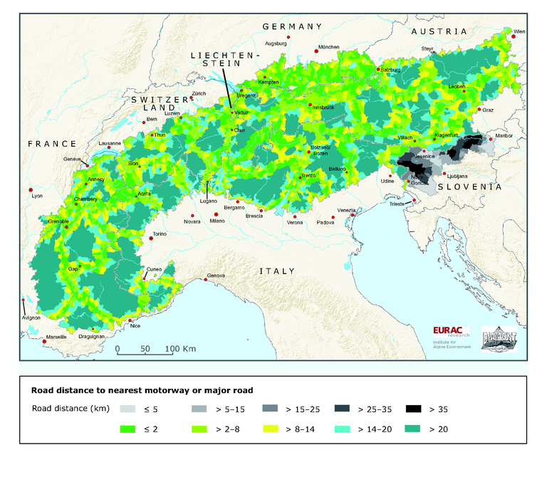
Road accessibility in km from the centre of municipalities to the next motorway or major road

Downloads
Data sources
Metadata
More info
Loading
Austria, France, Germany, Italy, Liechtenstein, Slovenia, Switzerland
2005-2007
Methodology
Based on Eurogeographic Seamless Administrative Boundaries of Europe (SABE2004 v1.0) at the level of LAU2 and using road data from Tele Atlas GmbH (2006): Multinet Vs. 2006.04 and Tele Atlas GmbH (2007): Multinet Vs. 2007.04. road distance are calculated from the centre of the municipality. For Slovenia data from the SI EuroGeographics (2005): EuroGlobalMap (EGM) v. 1.1 have been used.