All official European Union website addresses are in the europa.eu domain.
See all EU institutions and bodies
An official website of the European Union | How do you know?
Environmental information systems
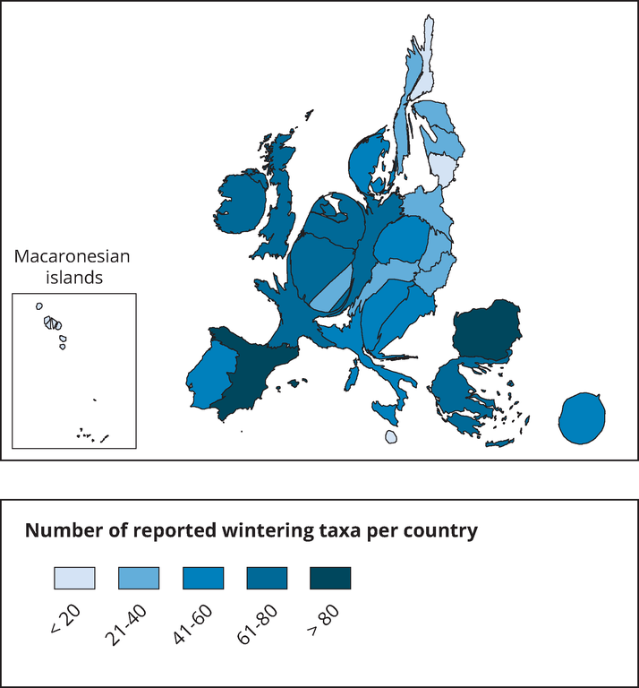
This map is a cartogram that distorts the geometry of regions to convey specific information by resizing. Here, the size of the country shows the number of reported species in relation to the country size. The map do not show all species appearing in a country. Thus, the map shows the reporting result rather than the species diversity of a country. The box on the bottom left refers to the Macaronesian islands (Azores, Madeira and Canary islands). Romania has not reported and is therefore not included in the map.
Loading