All official European Union website addresses are in the europa.eu domain.
See all EU institutions and bodies
An official website of the European Union | How do you know?
Environmental information systems
Assessment of Good Environmental Status for MSFD Descriptor 8 Contaminants (UPBT substances), 2018
Map (static)
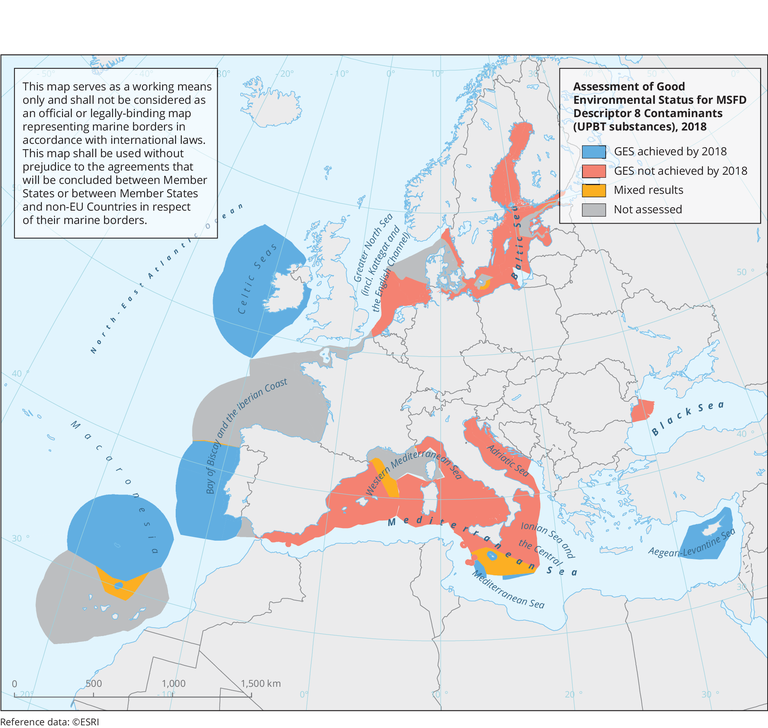
UPBT: ubiquitous, persistent, bioaccumulative and toxic substance.
The spatial extent of the GES assessment areas was defined as the marine waters surrounding the EU countries whose outer limit is defined by the 200 nm boundary from the coast, and the map does not show "not assessed" areas as the assessment is aggregated on the Marine Region scale.
Downloads
Data sources
Metadata
More info
Loading
- Belgium
- Croatia
- Cyprus
- Estonia
- Finland
- Germany
- Ireland
- Italy
- Latvia
- Lithuania
- Malta
- Netherlands
- Poland
- Portugal
- Romania
- Slovenia
- Spain
- Sweden
2012-2018
Additional information
- The maps shows only marine regions/subregions for which the GES status of Descriptor 8, feature Contaminants (UPBT substances) was assessed either as "GES achieved by 2018" or "GES not achieved by 2018". The map thus not shows areas with "Not assessed", "Unknown" or "Not relevant" GES status. The spatial extent of the GES assessment areas was defined as the marine waters surrounding the EU countries whose outer limit is defined by the 200 NM boundary from the coast, and the map does not show "not assessed" areas in marine reporting units scale; as the assessment is aggregated on the Marine Region scale.
- The results on the GES assessments under Article 8 per MRUs that are stored in the Onager Marine database (the database storing the data submitted by MS in Reportnet/CDR)
were extracted from: https://tableau-public.discomap.eea.europa.eu/.