All official European Union website addresses are in the europa.eu domain.
See all EU institutions and bodies
An official website of the European Union | How do you know?
Environmental information systems
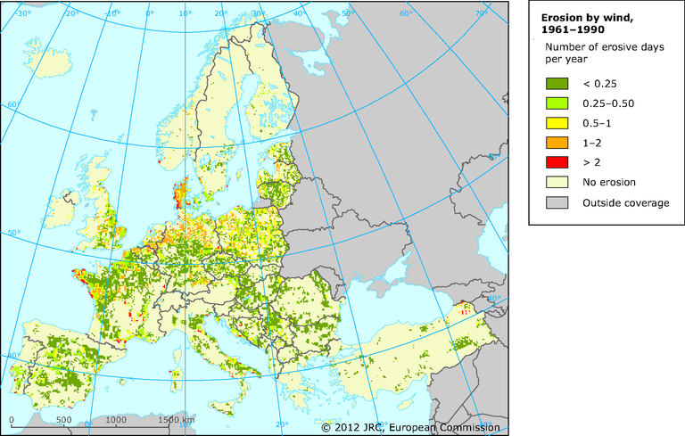
Calculations are based on wind velocity and soil texture.
While the overall patterns of erosion are generally sound, the validation of erosion data can be challenging. The data presented are currently being validated through comparisons with national datasets and expert judgement. In this sense, zooming in on a specific locality can give the impression of a situation that differs from reality.
Loading