All official European Union website addresses are in the europa.eu domain.
See all EU institutions and bodies
An official website of the European Union | How do you know?
Environmental information systems
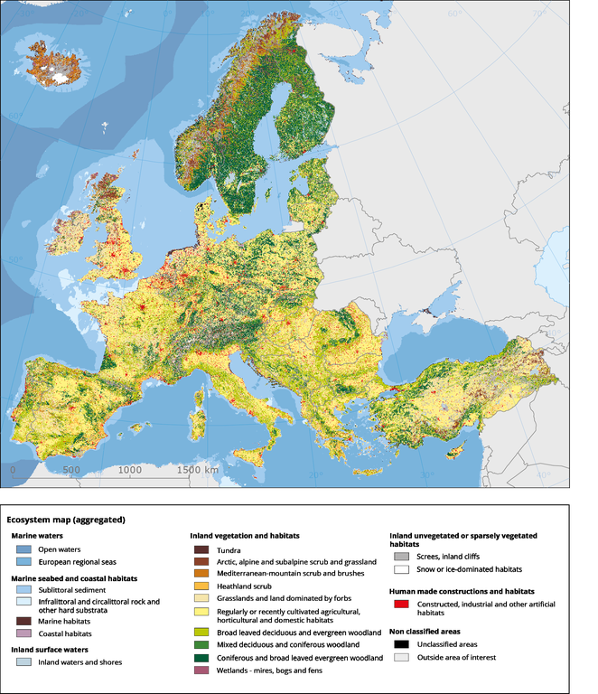
Ecosystem type map v2.1 - aggregated classes - (EUNIS Level 2) derived from CORINE Land Cover and additional spatial explicite european datasets according to defined rule set. The rule set builds on the crosswalk between EUNIS nomenclature and CORINE Land Cover nomenclature. The multiple assignements are resolved using additional data like Art. 17 reporting data on habitat types, soil data, HANTS phenological data, potential natural vegetation, elevation zones, etc.
Loading