All official European Union website addresses are in the europa.eu domain.
See all EU institutions and bodies
An official website of the European Union | How do you know?
Environmental information systems
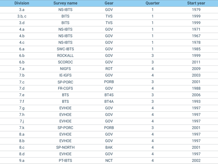
The table shows the Survey name, the International Council for the Exploration of the Sea (ICES) sub-division in which the survey is undertaken, the gear used in the survey, the initial start date of the survey and the quarter used for the assessments.
Loading