All official European Union website addresses are in the europa.eu domain.
See all EU institutions and bodies
An official website of the European Union | How do you know?
Environmental information systems
EN

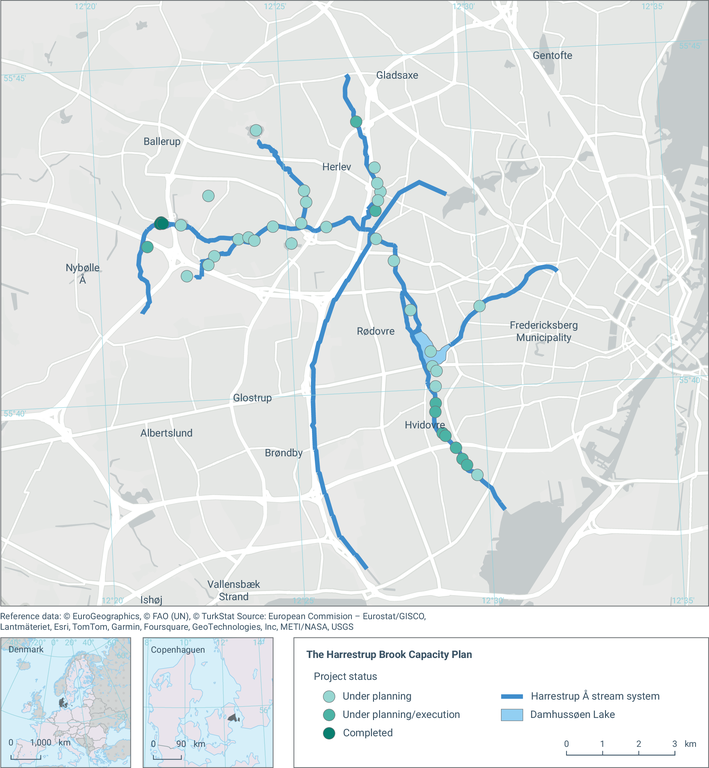
The map shows the planned interventions along the Harrestrup Brook to ensure sufficient capacity to reduce the impacts of flooding on the neighbouring residential areas
Loading