All official European Union website addresses are in the europa.eu domain.
See all EU institutions and bodiesAn official website of the European Union | How do you know?
Environmental information systems
EN
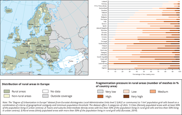
Fragmentation pressure from urban and transport infrastructure expansion in rural areas (see map) in the EU Member States. The chart shows the area distribution of fragmentation pressure classes in proportion of each country's rural area.
Loading