next
previous
items

Figure

Spatial distribution of species conservation status at Member State level represented in a 10 x 10 km grid

Figure Created 22 Sep 2020 Published 22 Sep 2020 Last modified 21 Apr 2021
1 min read
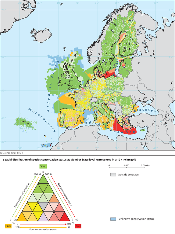
The map shows an index of conservation status of species calculated on a 10 x 10 km distribution grid

Metadata

Additional information

The Map illustrates conservation status as an index by 10 x 10 km
The data for the map is part of a tableau sql query. The query select the art17 cells from the ONAGER database directly.
Llink to the tableau project where this 2d-dashboards are included:
S:\Common workspace\Bio\Tableau\ART17\art17_2013-2018\Methods CS and trend map analysis\T04_Methods CS-EU and trend map analysis ART 17 species_v20.twb

Permalinks

Geographic coverage

Temporal coverage

Tags

Document Actions