All official European Union website addresses are in the europa.eu domain.
See all EU institutions and bodies
An official website of the European Union | How do you know?
Environmental information systems
EN

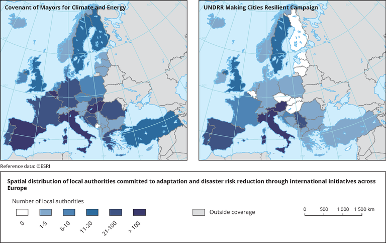
The map shows the number of local authorities per country that are signatories to the Covenant of Mayors (left map) or participate in the 'Making cities resilient' campaign by UNDRR (right map).
Loading