All official European Union website addresses are in the europa.eu domain.
See all EU institutions and bodiesAn official website of the European Union | How do you know?
Environmental information systems
EN
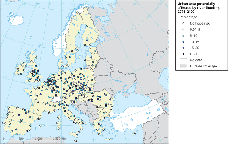
In many parts of Europe, the risk of river flooding is expected to increase; in north-eastern Europe, the probability of floods is expected to fall. Further to climate exposure, the placement of many new urban areas and the accumulation of assets in low-lying areas close to rivers has intensified the sensitivity to river floods.
The map shows the low-lying urban areas potentially threatened by river flooding in a one-in-a-century flood event, both for the current period and in the projected future. However, the map does not take into account eventual future changes in urban land-take, nor any adaptation measures like flood defences or flood retention that may lower the risk.
Loading