All official European Union website addresses are in the europa.eu domain.
See all EU institutions and bodies
An official website of the European Union | How do you know?
Environmental information systems
EN

- БългарскиBG
- češtinaCS
- HrvatskiHR
- danskDA
- NederlandsNL
- ελληνικάEL
- EnglishEN
- eestiET
- SuomiFI
- FrançaisFR
- DeutschDE
- magyarHU
- ÍslenskaIS
- italianoIT
- LatviešuLV
- lietuviųLT
- MaltiMT
- NorskNO
- polskiPL
- PortuguêsPT
- RomânăRO
- slovenčinaSK
- SlovenščinaSL
- EspañolES
- SvenskaSV
- TürkçeTR
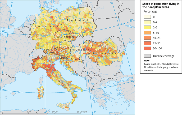
Share of population living in the floodplain areas
Map (static)
Floodplain percentage per subcatchment.
Downloads
Data sources
Metadata
More info
Loading
- Flood Hazard and Risk map, medium probability (Dataset URL is not available)
- Catchment characterisation and modelling 2 (CCM2)
Methodology
WSO4 subcatchments have been intersected with FHM (medium) areas. Population count have been calculated (zonal statistics) per WSO4 subcatchment as well all intersected flood hazard areas. Layers used in the process are Population density - grid, WSO4 subcatchment - shp and FHRM areas - shp. Column used for legend classification is named "percentage".