All official European Union website addresses are in the europa.eu domain.
See all EU institutions and bodiesAn official website of the European Union | How do you know?
Environmental information systems
EN
- БългарскиBG
- češtinaCS
- HrvatskiHR
- danskDA
- NederlandsNL
- ελληνικάEL
- EnglishEN
- eestiET
- SuomiFI
- FrançaisFR
- DeutschDE
- magyarHU
- ÍslenskaIS
- italianoIT
- LatviešuLV
- lietuviųLT
- MaltiMT
- NorskNO
- polskiPL
- PortuguêsPT
- RomânăRO
- slovenčinaSK
- SlovenščinaSL
- EspañolES
- SvenskaSV
- TürkçeTR
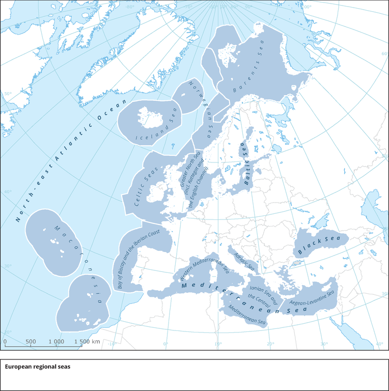
Regional seas surrounding Europe
Map (static)
Downloads
Data sources
Metadata
More info
Loading
Atlantic, Black Sea, Marine Arctic Ocean, Marine Baltic sea, Marine Black sea, Marine Macaronesian/Atlantic ocean, Marine Mediterranean sea, Marine North sea, North Atlantic Ocean
2019
Please note that neither the European Commission, the European Environment Agency nor its European Topic Centre for Inland, Coastal and Marine waters has competence in the geographical demarcation of EU Member States borders. This is also the case for establishing the limits of the continental shelf of EU Member States, where international law applies. According to UNCLOS art. 76 (8), only the coastal State is competent to establish the outer limits of its continental shelf. It is to act on the basis of the recommendations of the Commission on the Limits of the Continental Shelf. The map is not intended to influence or question any on-going negotiations occurring in UNCLOS or jurisdictional minded scenarios regarding maritime boundaries pertaining to EU Member States or third countries located in Europe´s seas. Neither the European Commission, the European Environment Agency nor its European Topic Centre for Inland, Coastal and Marine waters is responsible for the use that may be made of the map provided. As such, there is a disclaimer associated to the map: The map serve for information purposes only, and may not and shall not be construed as an official map representing maritime borders in accordance with international law