All official European Union website addresses are in the europa.eu domain.
See all EU institutions and bodies
An official website of the European Union | How do you know?
Environmental information systems
EN

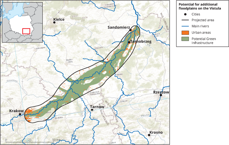
This map depicts the Vistula river basin land cover within Poland. This map was created in order to have a higher spatial resolution of this specific area.
Loading