All official European Union website addresses are in the europa.eu domain.
See all EU institutions and bodiesAn official website of the European Union | How do you know?
Environmental information systems
EN
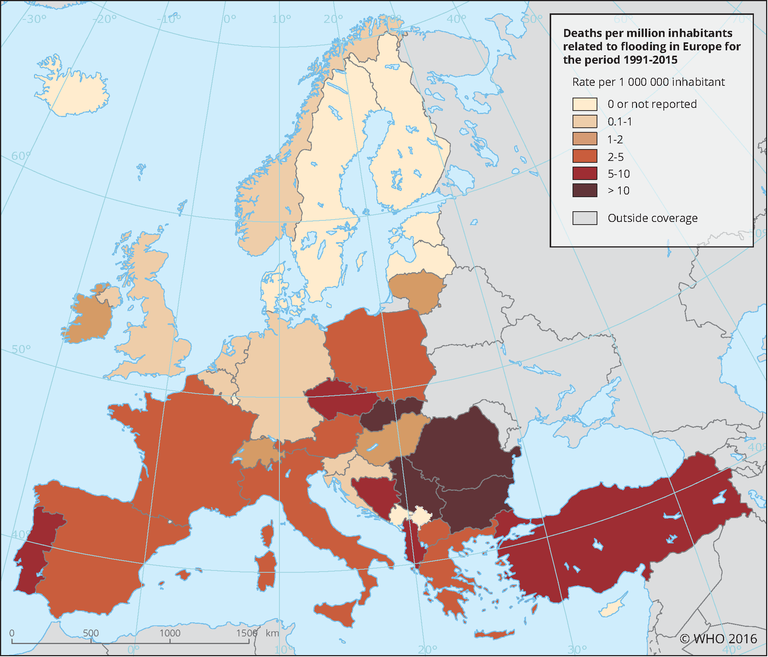
This map shows the number of deaths related to flooding per million inhabitants (cumulative over the period 1991–2015, with respect to 2015 population).
Loading