Figure
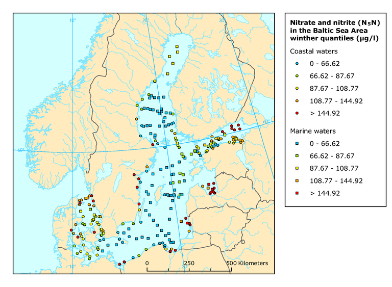
Mean winter surface concentrations of nitrate and nitrite in the Baltic Sea Area, 2004
Metadata
Additional information
Only stations with more than two years data are included.
Coastal stations are marked by circles and ICES open-water stations (>20 km from coast) by squares. Level of classification is based on the 20 % 40 %, 60 % and 80 % percentiles of the indicator presented.
Geographical coverage note: The Baltic Sea
Permalinks
- Permalink to this version
- BC325B5A-F51B-4B35-9394-023D1902A677
- Permalink to latest version
- 4D4FD483-BB13-430E-B5CA-2B842BA39BD5
Older versions
For references, please go to https://www.eea.europa.eu/data-and-maps/figures/mean-winter-surface-concentrations-of-nitrate-and-nitrite-in-the-baltic-sea-area-2004 or scan the QR code.
PDF generated on 30 Jun 2022, 07:32 PM
Document Actions
Share with others