All official European Union website addresses are in the europa.eu domain.
See all EU institutions and bodiesAn official website of the European Union | How do you know?
Environmental information systems
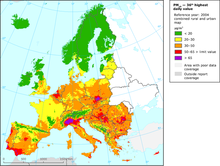
Map of PM10 concentrations in WCE and SEE, 2003, showing the 36th highest daily values at urban background sites superimposed on rural concentrations. Maps constructed from measurements and model calculations (EEA-ETC/ACC Technical Paper 2005/2008)
Map (static)

Downloads
Data sources
Metadata
More info
Loading
