All official European Union website addresses are in the europa.eu domain.
See all EU institutions and bodiesAn official website of the European Union | How do you know?
Environmental information systems
EN
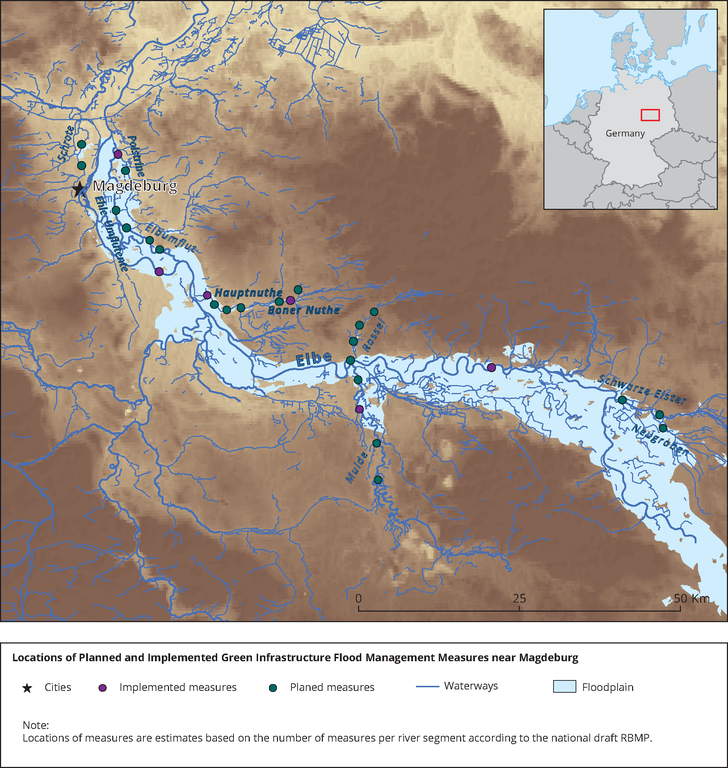
Locations of measures are estimates based on the number of measures per river segment according to the national draft RBMP and are therefore not exact.
Loading