All official European Union website addresses are in the europa.eu domain.
See all EU institutions and bodiesAn official website of the European Union | How do you know?
Environmental information systems
EN
- БългарскиBG
- češtinaCS
- HrvatskiHR
- danskDA
- NederlandsNL
- ελληνικάEL
- EnglishEN
- eestiET
- SuomiFI
- FrançaisFR
- DeutschDE
- magyarHU
- ÍslenskaIS
- italianoIT
- LatviešuLV
- lietuviųLT
- MaltiMT
- NorskNO
- polskiPL
- PortuguêsPT
- RomânăRO
- slovenčinaSK
- SlovenščinaSL
- EspañolES
- SvenskaSV
- TürkçeTR
Landscape fragmentation per 1 km² grid in the Channel region in 2009
Map (static)
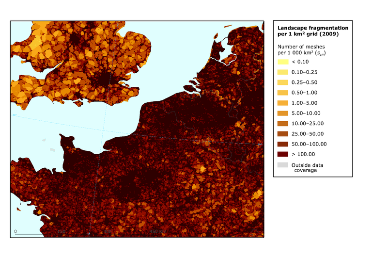
Map shows the patterns of fragmentation in the Channel region investigated based
on a grid of cells size of 1 km2

Downloads
Data sources
Metadata
More info
Loading
- Belgium
- France
- Germany
- Luxembourg
- Netherlands
- United Kingdom
2009
Methodology
Fragmentation geometry has been created from input data (TeleAtlas roads/rails, CLC urban classes, mountain areas / mountain ridges based on Nordregio and WorldClim data and rivers/lakes based on Catchment Characterisation and Modelling (CCM) v.2 database and CLC database) and landscape fragmentation metrics (Jaeger 2000) has been calculated.