All official European Union website addresses are in the europa.eu domain.
See all EU institutions and bodiesAn official website of the European Union | How do you know?
Environmental information systems
EN
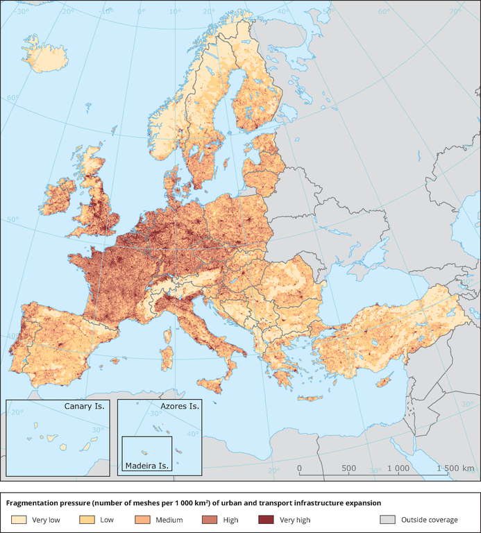
The map shows the distribution of fragmentation classes across Europe. Classes represent the number of meshes per 1 000 km2. Light colours mean less fragmentation pressure and dark colours mean higher fragmentation pressure of urban and transport infrastructure expansion.
Loading