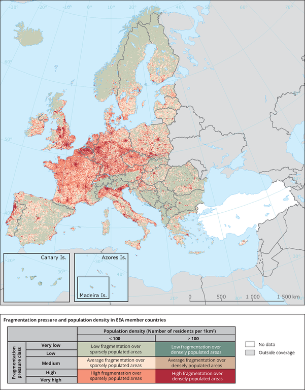
With the average population density in Europe in 2006 estimated at 114 inhabitants per km2 (Eurostat, 2011), the population density dataset was classified into densely populated areas (>100 inhabitants per km2) and into sparsely populated areas (<100 inhabitants per km2). The five fragmentation pressure classes were classified into 3 classes: 1) Very low and low number of meshes, 2) Medium number of meshes and 3) high and very high number of meshes. The three fragmentation classes and two resident population density classes were combined resulting in six combinations explained in the legend. The map shows data from the EU-28 countries, EEA Member States and Cooperating countries (EEA-39). No data available for Turkey.
This map relates to the "Landscape fragmentation pressure from urban and transport infrastructure expansion (LSI004)" indicator.