All official European Union website addresses are in the europa.eu domain.
See all EU institutions and bodies
An official website of the European Union | How do you know?
Environmental information systems
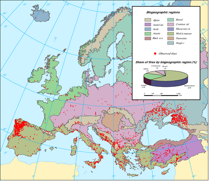
Note: This map is based on satellite observations of all types of fires, with non-forest fires filtered out as far as possible
Loading