All official European Union website addresses are in the europa.eu domain.
See all EU institutions and bodiesAn official website of the European Union | How do you know?
Environmental information systems
EN
- БългарскиBG
- češtinaCS
- HrvatskiHR
- danskDA
- NederlandsNL
- ελληνικάEL
- EnglishEN
- eestiET
- SuomiFI
- FrançaisFR
- DeutschDE
- magyarHU
- ÍslenskaIS
- italianoIT
- LatviešuLV
- lietuviųLT
- MaltiMT
- NorskNO
- polskiPL
- PortuguêsPT
- RomânăRO
- slovenčinaSK
- SlovenščinaSL
- EspañolES
- SvenskaSV
- TürkçeTR
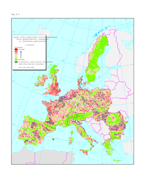
Areas with relatively little influence from urbanisation, transport or intensive agriculture
Map (static)
Note: Based on EEA Land cover data per November 1997
Downloads
Data sources
Metadata
More info
Loading
For Great Britain, Finland and Sweden a different methodology has been used, making direct comparisons with the rest of Europe uncertain. Influences from intensive forestry and recreation/tourism not included. The analysis of influences on nature in the map is based on an aggregation of land cover classes for areas with a high potential nature content; i.e. shrubs, heaths, natural grasslands and inland and coastal wetlands. It also includes forests irrespective of management type. These areas are generally susceptible to influences from neighbouring areas with intensive use or which are forming barriers or fragmentation nature areas; i.e. urban and industrial areas, transport structures, intensive agriculture. Water areas (lakes, rivers), grasslands and complex heterogeneous agricultural areas were considered neutral in the analysis = not influencing gravely.