Personal tools

Sign up now!
Get notifications on new reports and products. Currently we have 58293 subscribers. Frequency: 3-4 emails / month.
Follow us
Twitter icon Twitter
Facebook icon Facebook
YouTube icon YouTube channel
RSS logo RSS Feeds
Notifications archive

Write to us Write to us

For the public:


For media and journalists:

Contact EEA staff
Contact the web team
FAQ

Call us Call us

Reception:

Phone: (+45) 33 36 71 00
Fax: (+45) 33 36 71 99


next
previous
items

Skip to content. | Skip to navigation

Sound and independent information
on the environment

You are here: Home / Data and maps / Maps and graphs / The natural susceptibility for soils to compaction

The natural susceptibility for soils to compaction

Created : Dec 08, 2010 Published : Dec 08, 2010 Last modified : Nov 29, 2012 11:35 AM
Topics: , , ,
The map shows the natural soil susceptibility to compaction
This is the latest published version. .

Download

Metadata

Additional information

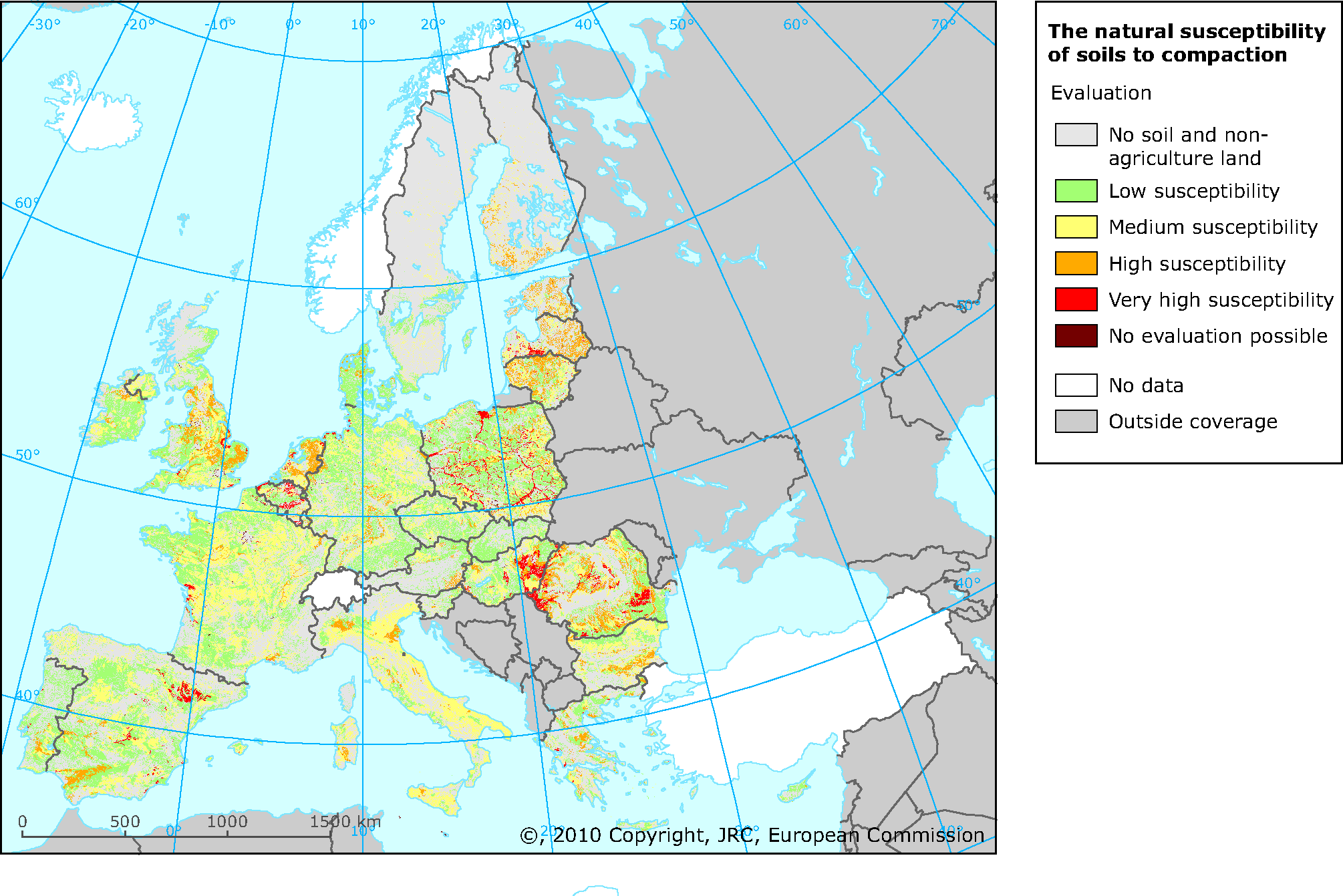
The map of natural soil susceptibility to compaction was created from the evaluation of selected parameters from the ESDB. The soil susceptibility to compaction was divided into 4 categories. Two additional categories represent the data concerning places where this evaluation was either not relevant or could not been provided because of lack of information. In total there are 6 categories:

0 - no soil. This represents water bodies, glaciers and rock outcrops

1 - low susceptibility to compaction

2. - medium susceptibility to compaction

3. - high susceptibility to compaction

4. - very high susceptibility to compaction

9. - no evaluation possible. This was the case of towns including also soils, soils disturbed by man and marsh.

European Environment Agency (EEA)
Kongens Nytorv 6
1050 Copenhagen K
Denmark
Phone: +45 3336 7100