All official European Union website addresses are in the europa.eu domain.
See all EU institutions and bodiesAn official website of the European Union | How do you know?
Environmental information systems
EN
- БългарскиBG
- češtinaCS
- HrvatskiHR
- danskDA
- NederlandsNL
- ελληνικάEL
- EnglishEN
- eestiET
- SuomiFI
- FrançaisFR
- DeutschDE
- magyarHU
- ÍslenskaIS
- italianoIT
- LatviešuLV
- lietuviųLT
- MaltiMT
- NorskNO
- polskiPL
- PortuguêsPT
- RomânăRO
- slovenčinaSK
- SlovenščinaSL
- EspañolES
- SvenskaSV
- TürkçeTR
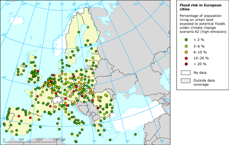
Exposure of population in European cities to flood risk under climate change (scenario A2 — high emissions; 100-years flood)
Map (static)
-
Downloads
Data sources
Metadata
More info
Loading
Per city, the population living in the Larger Urban Zone as described in the Urban Atlas/Urban Audit definition (GMES, 2010 and Eurostat, 2010) is considered. The calculation uses the population distribution on urban land-use classes from Corine land cover 2000. Furthermore, neither coastal floods nor flood protection measures are considered in the calculation. Based on the hydrological model LISFLOD.