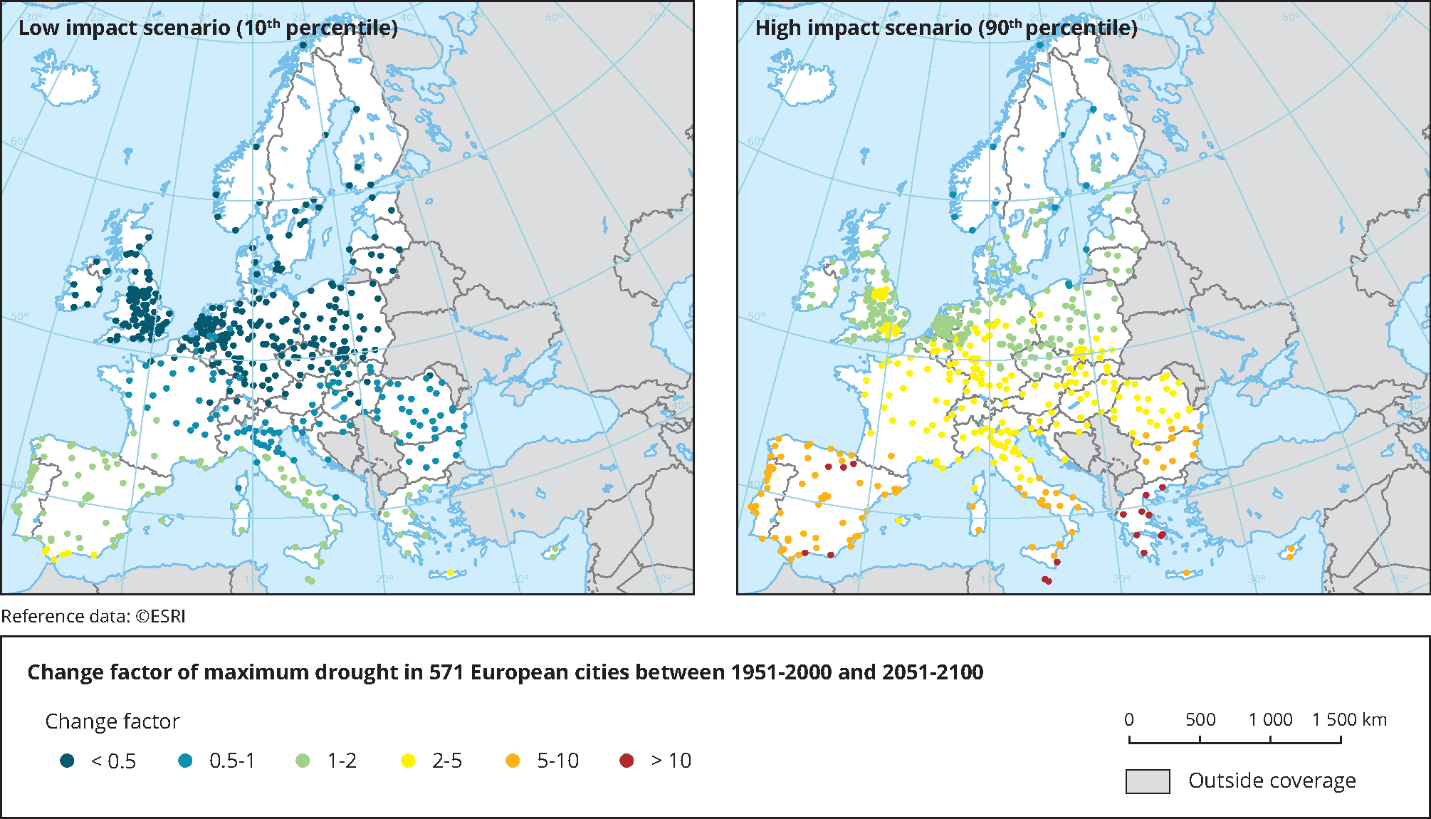
The 12-month scale Drought Severity Index (DSI-12) was used. It is based on cumulative monthly precipitation anomalies, where the absolute deficit (in mm) is divided by the mean annual rainfall and multiplied by 100. DSI-12 is a rainfall index and therefore does not account for an increase in drought due to increasing temperatures (and subsequently potential evaporation). The map shows the ratio of the maximum DSI-12 in the future to the maximum DSI-12 in the historical period. Based on 50 climate model projections from the Coupled Model Intercomparison Project Phase 5 (CMIP5; (Taylor et al., 2012), under the RCP8.5 climate scenario. Low impact scenario (left) refers to 10th percentile and high impact scenario (right) refers to 90th percentile of projections.
Source: Adapted from Guerreiro et al. (2018).

 taken in account for the measurement values(s) of the data resource.")
Document Actions
Share with others