5.1 Introduction
Air pollution modelling may be seen as a method for providing
information on air quality on the basis of what we know of the emissions, and of the
atmospheric processes that lead to pollutant dispersion, transport, chemical conversion
and removal from the atmosphere by deposition.
Models have become a primary tool for analysis
in most air quality assessments mainly for the following reasons:
- A picture of the air quality in a zone may be
obtained - in contrast to the limitations in the spatial coverage of air quality
measurements.
- The relation between air concentrations and the
emissions causing these can be made explicitly and quantitatively by modelling, which is
most important for supporting air quality management.
- Models are the only available tool if the impact on
air quality of possible future sources or of alternative future emission scenarios is to
be investigated.
Air pollution models can be used in a
complementary manner to air quality measurements, with due regard for the strengths and
weaknesses of both analysis techniques. Modelled information is necessarily uncertain due
to deficiencies in our knowledge of emissions and atmospheric processes; this disadvantage
may be largely offset by validation of models with the help of measurements, or by
assessing air quality by combination of information from modelling and measurements. In
fact, if a concentration map is to be made on the basis of measurements, model results
provide essential information for interpolation. The use of interpolation in assessments
of air quality measurements alone is to be recommended only if emission information cannot
be made available or if acceptable models cannot be found, and if monitoring data with
sufficient spatial and temporal coverage are available.
5.2 Selection and application of models
For air quality assessment by modelling, a wide variety of models
have been developed, some of which have been made readily accessible and easy to use by
combination with user-friendly software. Others can only be operated by specialists, or
even exclusively by the developers. Information on the state of the art of modelling and
on models and model applications is available in various EEA publications prepared by the
European Topic Centre on Air Quality (Moussiopoulos et al., 1996; de Leeuw et al.,
1996, Tønnesen et al., 1997) and others (Olesen and Mikkelsen, 1992; Kretzschmar et al.,1994,
1996; NATO-CCMS, 1992, 1994, 1996; COST 615, 1996)
The European Topic Centre on Air Quality has
prepared a pilot model documentation centre accessible via the Internet (ETC-AQ home page:
http://www.etcaq.rivm.nl; model documentation
centre: http://aix.meng.auth.gr/lhtee/database.html).
Here, descriptions of the models, their application areas and their status with respect to
evaluation and validation are to be provided.
Models and model applications can be
distinguished on the basis of many criteria, such as the underlying physical concepts, the
temporal and spatial scale, type of source, type of component and type of application. For
assessments under the EC Air Quality Directives almost the whole range of the above
criteria is involved.
In particular for assessing air quality in an
urban environment, where often the highest concentrations are found, one should be aware
of the following aspects:
- Spatial scale. The local-to-regional scale models
(see Moussiopoulos et al., 1996) are broadly speaking related to the mesoscale. It
has been recognized that, particularly in southern Europe, urban scale problems (local
circulation systems, as sea and land breezes) can only be treated successfully by the aid
of mesoscale air pollution models in a sufficiently large model domain.
- Temporal scale. Both short term models (maximum
hourly concentrations) and long-term models (yearly mean concentrations) are needed.
Meteorological statistics are needed for calculation of percentiles and/or exceedance
frequencies.
- Underlying physical concept. There is a variety of
models that can be considered. For example, in case of uniform terrain, representative
meteorological data and appropriate emission data, the Gaussian models provide reliable
results for long term average values of relative inert pollutants such as SO2,
NOX and lead. In complex meteorological and topographical conditions however,
the transport processes may be conveniently simulated by the aid of models which solve
numerically the atmospheric diffusion equation (Eulerian approach) or describe fluid
elements that follow the instantaneous flow (Lagrangian approach). Both approaches are
usually embedded in prognostic meteorological models.
- Type of application. This report is mainly concerned
with regulatory applications. The relevant models are able to provide spatial distribution
of high episodic concentrations and of long-term averaged concentrations for comparison
with air quality limit values or thresholds.
- Type of source. Usually, in a city, all the source
categories are involved (e.g. line, point and area sources). For studying the urban air
quality, most of the small sources are combined into larger area sources, while the
largest point sources are often considered individually in the calculation.
- Type of component. In case of reactive pollutants,
chemical modules should be included in the model. The complexity of these modules varies
from those including a simple reaction (e.g. transformation of SO2 into
sulfates) to those describing photochemical reactions as in the cases of ozone and NOX.
Although atmospheric models are a basic tool
in air quality assessment studies their limitations should always be taken into account.
Thus, before attempting to select or apply a model one should have in mind that
uncertainties in model results may be large, introduced either by the model concept and/or
by the input parameters. In particular:
- There is no one model capable of properly addressing
all conceivable situations even for a broad category such as point sources.
- Meteorological as well as topographical complexities
of the area, which are usually associated with potential exceedance of air quality
standards, are rarely responsive to a single mathematical treatment; case-by-case analysis
and judgement are frequently required.
- Consistency in the selection and application of
models, input data and air quality data is very important. It is useless to calculate an
air quality field with a spatial resolution that is much higher than that of the emission
field.
- It is necessary to get balance in the detail and
accuracy of the data involved: emissions inventory, meteorological data, and air quality
data. Availability of appropriate data should be investigated before applying any model. A
model that requires detailed, precise input data should not be used when such data are not
available.
- The representativeness of model results may be
limited; in most models a spatial and temporal averaging is introduced which may
complicate a direct comparison with measurements at a given location and time.
- The involvement of specialists is necessary whenever
the more sophisticated models are used or the area of interest has complicated
meteorological or topographic features.
Particularly for first screening purposes, or
in case of limited input information, the use of simple models may be appropriate. A
description of such simple air pollution models for calculating the concentrations from
different sources in an urban environment is provided in Annex 5.1.
If initial screening leads to the conclusion that levels may be of the order of the limit
values, more sophisticated models should be selected.
In short, the procedure for modelling involves
the following steps:
1
Define the
pollutant, and the output quantity to be modelled (concentration fields, or (spatial
maximum) concentrations in streets or near point sources, usually for concentration
statistics, for instance annual average, 98 percentile of hourly values ...)
2
Define the
time resolution needed (the averaging time for the concentration)
3
Define the
"model output area" for which the model calculations should be made (usually a
zone or agglomeration) and the spatial resolution needed.
4
Define the
accuracy in the output quantity that is required
5
Determine the
model area (this may extend considerably beyond the output area, particularly in case of
pollutants with long range transport!)
6
Investigate
the availability of emission data (in the model area)
7
Investigate
the availability meteorological and topographical data (in the model area)
8
Investigate
available air quality data (in the model output area)
9
Check
available computer resources
10
Select models
that are suitable for the pollutant (taking into account its chemistry and deposition),
for the relevant output quantity, with the appropriate resolution in space and time,
within the required accuracy, and for the area under consideration (taking into account
its topography and meteorological characteristics)
11
Consider the
computer requirements of the model(s); if these surpass available computer resources,
reconsider model choice.
12
Reconsider
the requirements on emission and meteorological data of the model(s) selected and, if
necessary, collect more detailed input data (or reconsider the model choice)
13
Prepare input
data
14
Run the model
15
Compare
results to available air quality data and critically evaluate. If necessary, rerun model
(This will involve specialists guidance). Annex 5.2 lists model
evaluation parameters (Grønskei et al., 1997) that are recommended for comparing
model results and air quality data.
16
Map output;
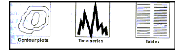
here various forms of output can be made, for example
Contour plots appropriate for
presenting the concentration fields and the spatial maxima. Time series appropriate for calculating the exceedances,
annual average, 99.7 percentiles.
Tables appropriate for presenting the concentration
statistics.
17
Assess
uncertainty.
5.3 Application to four pollutants
In the following tables, some aspects are considered of model
studies for the four pollutants for which a Daughter Directive is currently under
discussion. The models listed do not form a complete list of suitable models, and are not
indicative for any preference, but merely serve as examples. These models generally
calculate the contribution of particular sources to the concentration; a background
concentration, either obtained from wider scale modelling, or from measurements, is then
added.
|
Quantities to be calculated
|
Source characteristics
|
Examples of models used
|
| Sulphurdioxide |
- 24 h average concentration
exceedances < 3 times a year (approximately
a 99 percentile)
- 1h average concentration
exceedances < 24 times a year (approximately a 99.7 percentile)
- annual average concentration
example: (Borrego et al. 1996)
|
- mainly from elevated point sources for
power or heat generation
- Long-range transport (over distances of
1000 km and more) is very important
- Locally, small point sources,
residential heating and traffic may be contributing to exceedances. These local sources
may be taken into account as area or line sources.
|
- Microscale (urban roadways)
ADMS-Urban (Carruthers et al., 1995), UDM-FMI (Kukkonen et al.,
1996),CAR (Eerens et al., 1993) CAR-FMI (Harkonen et al., 1995), MISCAM (Eichhorn
et al., 1996),OSPM (Berkowicz et al,1997) ABC (Röckle, 1990), CPBM (Yamartino and
Wiegand, 1986), MUKLIMO (Sievers, 1986)
- sub-mesoscale (area sources)
UDM-FMI (Kukkonen et al., 1996),TREND (van Jaarsveld, 1995), PAL
(Petersen and Rumsey, 1987)
- Elevated point sources STACKS (Erbrink, 1995), IFDM (Cosemans et al., 1992), UDM-FMI (Kukkonen et
al., 1996), HPDM (Hanna and Chang, 1993), TREND (van Jaarsveld, 1995), OML (Olesen et al.,
1992), ADMS (Carruthers et al., 1995), ISC (EPA, 1987), CTDMPLUS (Perry et al., 1989),
POLARIS (Borrego et al., 1996)
|
| Particulate
matter |
- annual average PM10 conc.
|
- point stationary combustion sources
- area sources for residential heating
- area or line sources for road traffic
for secondary fraction of PM10, sources of SO2, NOX
and NH3 in a large area to be taken into account.
|
Models
should be capable to calculate secondary sulphate, nitrate and ammonium aerosol, next to
calculating dispersion and transport of PM10. As removal by deposition is strongly
dependent on particle size, the size distribution of the particles should be taken into
account in non-local applications. |
Nitrogen
dioxide
and nitrogen oxides |
- 1h average concentration exceedances < 8 hours a year (equivalent to 99.9 percentile) example: (Valkonen et al., 1996)
- annual average NO2 conc.
- annual average NOX (NO+NO2)
|
- area or line sources for road traffic
- elevated sources for power generation
- Exceedances may be primarily expected in
streets or in districts with heavy traffic, or close to industrial sources of NOX.
|
- Microscale (urban roadways)
The models may be the same with the ones for SO2 with the
addition of a simple atmospheric chemistry scheme for NO2 transformation
- sub-mesoscale (area sources)
UDM-FMI (Kukkonen et al., 1996), ADMS-Urban (Carruthers et al.,
1995), OZIPM4/EKMA (Jeffries and Sexton, 1987)
- Elevated point sources In mesoscale, the models may be the same with the ones for SO2,
with the addition of a simple atmospheric chemistry scheme for NO2
transformation and deposition:
UDM-FMI (Kukkonen et al., 1996),
or more comprehensive photochemical models:
UAM (Chico and Lester, 1992), CALGRID (Yamertino et al, 1992), CIT
(Russel et al., 1988), EZM (Moussiopoulos, 1995)
|
| Lead |
annual
average conc. of Pb |
- road traffic, (diminishing source due to
penetration of lead-free gasoline). Possible exceedances to be expected in streets with
busy traffic in countries where leaded gasoline is still in use.
- point sources of metal industries where
exceedances are expected due to major emissions both from chimneys and from ore heaps.
|
- Microscale (urban roadways) As for SO2
- sub-mesoscale (area sources)
As for SO2
- Elevated point sources
- Stock piles
|
|
Key measurements - necessary data for different source
types
|
|
line sources
|
area sources
|
elevated point sources
|
|
microscale - street canyons
|
microscale small point sources
|
|
- source data
location of road, road width, height and configuration of buildings
along road, vehicle type, vehicle count, vehicle average speed, monthly/hourly variation
emission
- meteorological data (on hourly basis)
date, time cloud cover, temperature, wind speed and direction at
roof level
- background concentrations
|
- source data
source dimensions, height, location and orientation, monthly/hourly
variation emission
- meteorological data (on hourly basis)
date, time cloud cover, temperature, wind speed
and direction
- background concentrations
|
- source data
location, source height, diameter, efflux
velocity, efflux temperature, pollutant emission rate, monthly/hourly variation emission
- meteorological data (on hourly basis)
date, time, cloud cover, temperature, net
radiation, wind speed and direction. Atmospheric boundary layer parameters as mixing
height and wind profile.
For mesoscale/ long range transport where the surface wind
climatology is not uniform, the field of many atmospheric parameters may be necessary
- receptor data
terrain height at receptor location.
For long range transport the terrain description is necessary
- background concentrations
|
| chemical
data: If chemistry is involved data for spatial and temporal emission inventory are
necessary. Also indicated background concentrations at the examined area. |
5.4 Uncertainty of model results
Uncertainty assessment gives a measure of how a model can simulate
real world conditions. Whereas in assessing model validity the emphasis is placed on the
segments that comprise the model, in assessing model accuracy-uncertainty the emphasis
shifts to the model accuracy as a complete unit.
There are at least four fundamental
difficulties in comparing air quality observations to model predictions:
- On the scale of the model, the observations are
points in space, whereas the predictions generally represent volume averages.
- The observations contain measurement errors or
uncertainties
- The model may not represent properly the atmospheric
processes involved
- Errors in the model input parameters (emission and
meteorological data) may affect model results. Even if a model is an ideal formulation of
the process, the predictions will be in error if the inputs are in error.
Annex 5.3 provides information on model
uncertainty related to meteorology.
From the information presented in this Annex,
an accuracy of ±10% may be envisaged for ensemble averages in the most ideal combinations
of circumstances, or perhaps 10-20% for certain long-term averages in less ideal
circumstances (excluding the special cases of stagnant or confined airflow), but in many
circumstances of practical interest the uncertainties may at best be several tens per cent
statistically for the whole zone and factors of two or more for individual points within
the zone.
Concerning the accuracy of urban photochemical
models, (having in mind that the measurement errors are on the order of at least 10%) we
should generally expect:
- the models have difficulty predicting the maxima at
the right time and place, although the predicted peaks are in the correct general areas
and the offsets in time are random within 2h limits. Thus it is rather difficult to
predict the peaks in the same location as a monitoring network.
- the outputs between different models vary only in the
location of the peaks, rather than everywhere on the grid.
- underprediction of the estimated concentrations. An
evaluation study showed that several photochemical models underpredicted the daily maximum
(from anywhere in the region), with biases ranging from 10-30% and correlation
coefficients above 0.8. For the case of daily maximum constrained to the monitoring sites,
the estimated biases ranged from 31 to 42%.
- less variance in the predictions than the variance in
the observations
Some methods for assessing the accuracy of a
specific air quality model by comparing modelled results to measured concentrations are:
Bias evaluation
|
Ratio of the difference between
the mean predicted concentration and the mean observed concentration to the mean observed
concentration
|
|
Error analysis |
The root mean square of the
difference between predicted and observed concentrations |
|
|
Correlation between observed and
predicted concentration with time at a given station |
|
|
Correlation between observed and
predicted concentration distributions across a monitoring network at a given time |
|
|
Comparisons of magnitudes and
locations of peak observed and predicted concentrations
|
|
|
Observed and
predicted cumulative distribution functions are compared to see if they are significantly
different |
Annex 5.1 provides formulae for some of
these methods.
Time and space correlations are useful, but it
should be realised that the correlation coefficients can mask many strange variations in
the data. For this reason, a combination of evaluation methods is best, including a
subjective judgement by an experienced modeller.
In general, most urban diffusion models yield
correlations between hourly values of observed and predicted concentrations at a given
station of about 0.6 to 0.8. According to Hanna et. al (1982) this result seems to
be independent of the number of statements in the computer model. Good results appear to
depend mainly on good knowledge of emissions and wind velocities.
5.5 References
- Berkowicz,R., Hertel,O., Sørensen N.N. and Michelsen, J.A.,(1997)
Modeling air pollution from traffic in urban areas.In: "Flow and Dispersion trough
Obstacles" R.J.Perkins, S.E. Belcher, Eds. Clarendon, Oxford.
- Borrego C., Lemos S., Guerreiro C. and Martins
J. M., (1996)" A second generation Gaussian dispersion model - the POLARIS
Model" 4th workshop on harmonization within atmospheric dispersion modelling for
regulatory purposes, vol 1 and 2. E&M.RA9603, VITO, Mol, Belgium.
- Carruthers D. J., Davies B. M., Edmunds H. A.,
Ellis K. L., Mchugh C. A. and Thomson D. J. (1995) "ADMS, the Atmospheric Dispersion
Modelling System: Comparisons with data from Kincaid, Lillestrom and Copenhagen."
Proc. 3rd Workshop on Harmonisation within Atmospheric Dispersion Modelling for Regulatory
Purposes, Intl. J. Environment and Pollution, Vol 5, No. 4/5/6.
- Chico T. and Lester J. (1992) Application of
the Urban Airshed Model for two SCAQS episodes in the South Coast Air Basin. Southern
California Air Quality Study Data Analysis Conference, Los Angeles, CA.
- Cosemans, J. Kretzschmar J., and Maes G.,
(1992), "The Belgian Immission Frequency Distribution Model IFDM" Proceedings of
the DCAR workshop on objectives for the next generation of practical short range
atmospheric dispersion models. May 6-8, 1992, Risø, Roskilde, Denmark.
- COST-action 615 (1996), Dispersion of air
pollutants in urban environment. Overview of models and datasets.
- de Leeuw, F.A.A.M., Berge, E. Gronskei,
K.,Tombrou, M. (1996) Review on requirements for models and model application, EEA Topic
Report 18, EEA, Copenhagen
- Eichhorn J., Beltz N. and Heil O. (1996)
"A Microscale Pollution Dispersal Model for Road Traffic Related Pollution -
Simulation and Measurements", 4th workshop on harmonization within atmospheric
dispersion modelling for regulatory purposes, vol 1 and 2. E&M.RA9603, VITO, Mol,
Belgium.
- Eerens, H.C., Sliggers, C.J., van den Hout,
K.D. (1993) The CAR model: the Dutch method to determine city street air quality. Atm.
Env. 27B, 389-399.
- EPA, (1987) Industrial Source Complex (ISC)
Dispersion Model User's Guide. Second Edition. Research Triangle Park, NC., U.S.
Environmental Protection Agency.
- Erbrink J.J. (1995) Turbulent diffusion from
tall stacks. The use of advanced boundary layer meteorological parameters in the gaussian
dispersion model "STACKS". Ph.D. Thesis, Free University, Amsterdam.
- Grønskei K.E., Berge E., Larssen S., de Leeuw
F., Moussiopoulos N. and Tombrou M. (1997) Selection of models and inputs data for groups
of Applications. Draft EEA Topic Report.
- Hanna R. S. and Chang J. C., (1993),
"Improvements and testing at three field sites", Atmospheric Environment, Vol.
27A, No. 9,1491-1508.
- Harkonen J., Valkonen E., Kukkonen J.,
Rantakrans E., Jalkanen L., and Lahtinen K., (1995), "An operational model for the
dispersion of dispersion of vehicular pollution from a road" International Journal of
Environment and Pollution, Vol. 5, Nos. 4-6.
- Jeffries H. E. and Sexton K. G. (1987)
Technical discussion related to the choice of photolytic rates for carbon bond mechanism
in OZIPM4/EKMA. U.S. EPA report No. 450/4-87-003.
- Kretzschmar, J.G., Cosemans G.(1996) 4th
workshop on harmonization within atmospheric dispersion modelling for regulatory purposes,
vol 1 and 2. E&M.RA9603, VITO, Mol, Belgium.
- Kretzschmar, J.G., Maes, G. Cosemans G.( 1994)
Operational short range atmospheric dispersion models for environmental impact assessment
in Europe, vol 1 and 2. E&M.RA9416, VITO, Mol, Belgium.
- Kukkonen J., Harkonen J., Valkonen E.,
Karppinen A. and Rantakrans E., (1996) "Regulatory Dispersion Modelling in
Finland", 4th workshop on harmonization within atmospheric dispersion modelling for
regulatory purposes, vol 1 and 2. E&M.RA9603, VITO, Mol, Belgium.
- Moussiopoulos, N. (1995) The EUMAC Zooming
model, a tool for local-to-regional air quality studies. Meteorol.Atmos.Phys., 57,
115-133.
- Moussiopoulos, N.,Berge, E., Bohler, T., de
Leeuw, F.A.A.M. ,Grønskei, K., Mylona, S., and Tombrou, M.,(1996) Ambient air quality,
pollutant dispersion and transport models. EEA Topic Report no 19, EEA, Copenhagen.
- NATO-CCMS (1996), Air Pollution Modeling and
its application XII, S-E Gryning and F.A. Schiermeier, eds, Plenum Press, New York.
- NATO-CCMS (1994), Air Pollution Modeling and
its application XI, S-E Gryning and M.M. Millan, eds., Plenum Press, New York.
- NATO-CCMS (1992), Air Pollution Modeling and
its application X, H.van Dop and G.Kallos, eds., Plenum Press, New York.
- Olesen, H.R. and Mikkelsen, T. (1992)
Objectives for next generation of practical short-range atmospheric dispersion models.
DCAR, NERI, Roskilde, Denmark.
- Olesen, H.R., Lofstrom P., Berkowicz R.,
Jensen A. B., (1992). "An Improved Dispersion Model for Regulatory Use - The OML
model", Air Pollution Modelling and its Application IX, Plenum Press, New York.
- Perry S. G., Burns D. J., Adams L. H., Paine
R. J., Dennis M. G., Mills M. T., Strimaitis D. G., Yamartino R. J. and Insley E. M.
(1989) User's Guide to the Complex Terrain Dispersion Model Plus Algorithms for Unstable
Situations (CTDMPLUS). Research Triangle Park, NC., U.S. Environmental Protection Agency
(EPA-600/8-89-041).
- Petersen W. B. and Rumsey E. D., (1987) User's
Guide for PAL2.0, a Gaussian-plume algorithm for point, area and line sources. Research
Triangle Park, NC., U.S. Environmental Protection Agency.
- Röckle R (1990) Bestimmung det
Strömungsverhältnisse im Bereich komplexer Bebauungsstrukturen. Dissertation, TH
Darmstadt.
- Russell A,G., McCue K.F., Cass G.R., (1988)
Mathematical modelling of the formation of nitrogen containing pollutants-I. Evaluation of
an Eulerian photochemical model. Environ. Science and Technol., 22, 263-271.
- Tønnesen,D., De Leeuw, F., Moussiopoulos, N.
(1997) Model applications in the assessment of urban air quality, Final draft report to
EEA. European Topic Centre on Air Quality
- Sievers U. and Zdunkowski W. (1986) A
microscale urban climate model. Beitr. Physik der Atmosphäre, 59, 13-19.
- Spalding D. B. (1981) A general purpose
computer program for multi-dimensional one and two phase flow. Math. Comput. Simulation 8,
267-276.
- Valkonen E., Harkonen J., Kukkonen J.,
Rantakrans E., Jalkanen L. and Haarala S., (1996), " Dispersion Model Computations on
Urban Air Pollution for Analyzing the Health Effects", 4th workshop on harmonization
within atmospheric dispersion modelling for regulatory purposes, vol. 1 and 2.
E&M.RA9603, VITO, Mol, Belgium.
- van Jaarsveld, J.A. (1995) Modelling the
long-term atmospheric behaviour of pollutants on various spatial scales. Thesis, Utrecht
University; RIVM report 722501005, RIVM, Bilthoven, the Netherlands.
- Yamartino R.J. and Wiegand G. (1986)
Development and evaluation of simple models for the flow, turbulence annd pollutant
concentrations fields within an urban street canyon. Atmospheric Environment, 20,
2137-2156.
- Yamartino R.J., Scire J.S., Carmichael G.R.
and Chang Y.S. (1992) The CALGRID mesoscale photochemical grid model. - I Model
formulation. Atmospheric Environment, 26A, 1493-1512.

Document Actions
Share with others