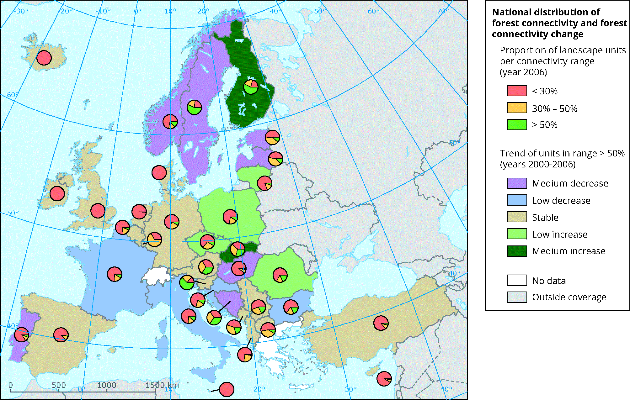
How to read the map:
The proportion of landscape units per connectivity ranges is reported by country for the year 2006. The trend (medium/low increase/decrease or stable) of the proportion of units in a high connectivity range (above 50%) is given for the period 2000-2006 per country. Estonia and Lithuania, two countries with the same amount of forests (2.2 million ha), exhibit a different landscape distribution per connectivity ranges (81% of landscapes with poorly connected woodlands in Lithuania versus 51% in Estonia). In the period 2000-2006, landscapes with well-connected forest lands (connectivity above 50%) tended to increase in Lithuania but to decrease in Estonia.
Source: European Commission-Joint Research Centre (JRC); Estreguil et al., 2012


Document Actions
Share with others