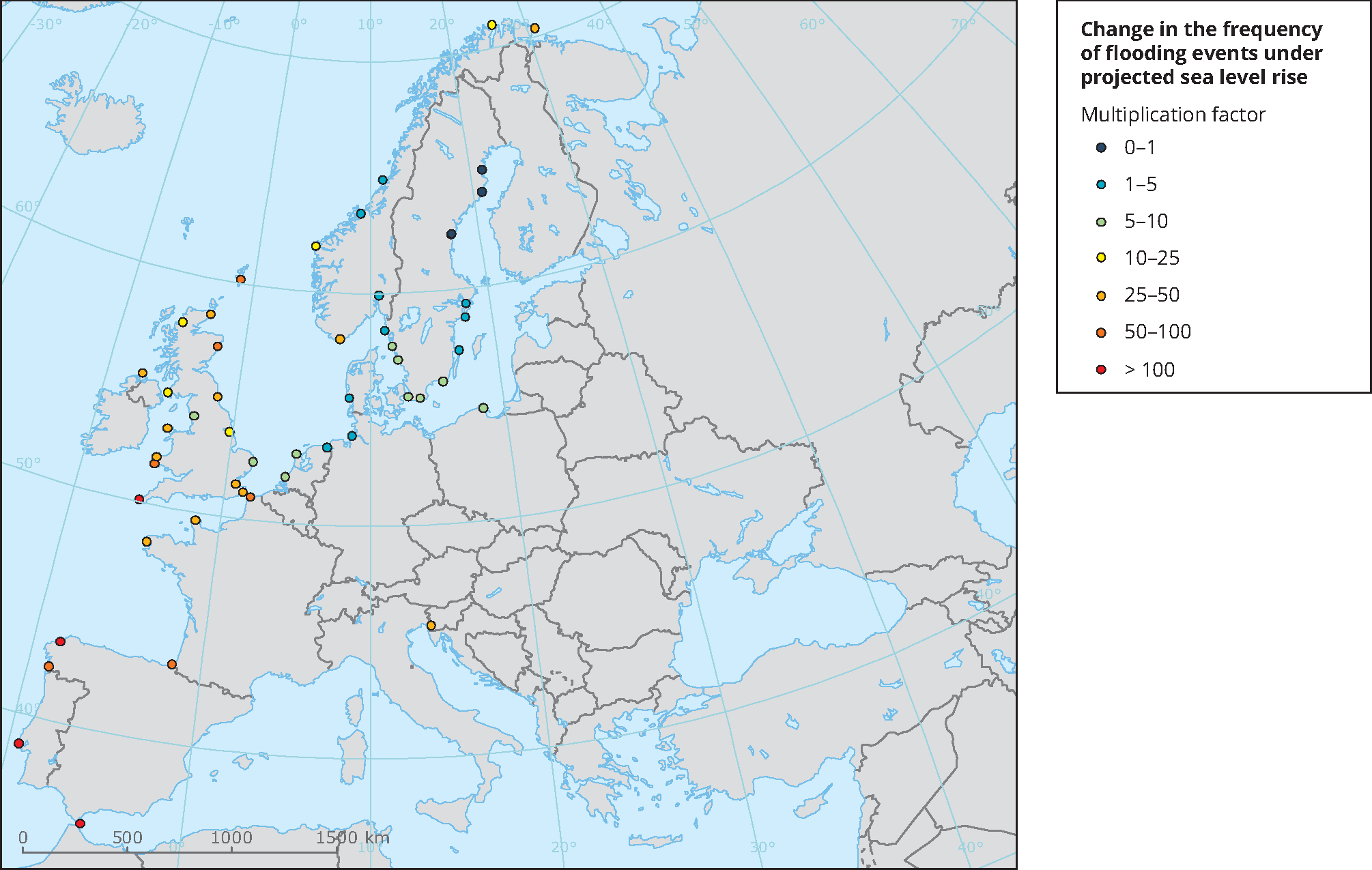
Source: Adapted from Figure 13.25(b) of the Working Group I contribution to the IPCC Fifth Assessment Report (http://www.climatechange2013.org/images/figures/WGI_AR5_Fig13-25.jpg)
Sea-level data from tide gauges were supplied by European Sea-Level Service, Global Sea Level Observing System (GLOSS) Delayed Mode Centre, Helpdesk Water (Netherlands), Instituto Español de
Oceanographia (Spain), Istituto Talassografico di Trieste (Italy), Marine Environmental Data Service (Canada), National Oceanography Centre Liverpool (UK), National Tidal Centre (Bureau of Meteorology, Australia), Norwegian Mapping Authority, Service Hydroographique et Océanographique de la Marine (France), Swedish Meteorological and Hydrological Institute and University of Hawaii Sea Level Centre (USA). Sea-level rise projections are based on the CMIP5 ensemble of global climate models.


Document Actions
Share with others