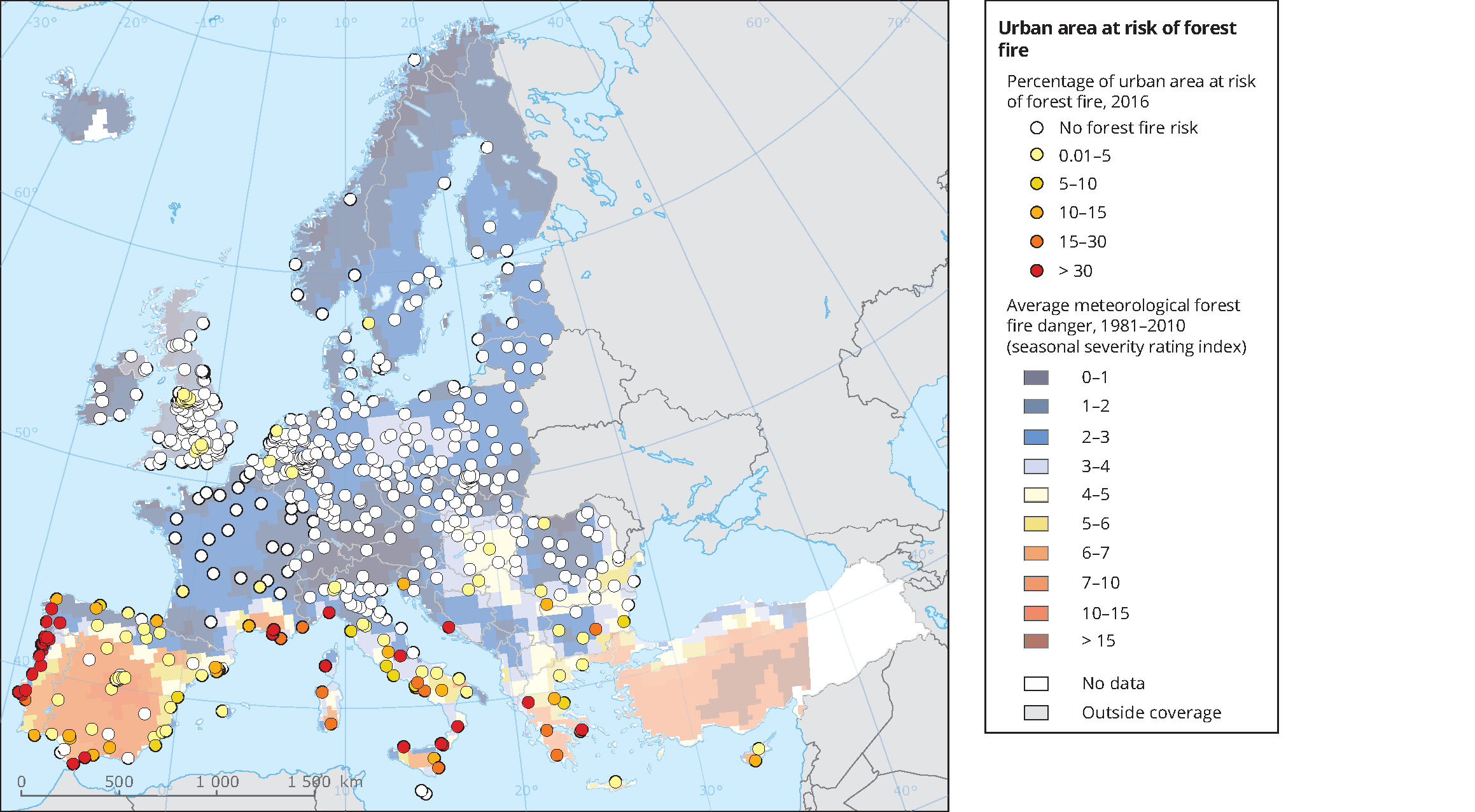
The steadily growing interface between vegetated land and urban areas resulting from urban growth and sub-urbanisation in recent decades has amplified the risk of forest fires in many residential areas, especially where cities border forest areas. Factors such as urban density, vegetation characteristics, and the isolation of urban areas from other urban areas and services like transport increase the risk.
It is estimated that around three-quarters of fire ignition points in Mediterranean countries are located at the urban fringes, which combine a high aggregation of vegetation and a high density of houses. Forest fires in Greece in 2007 caused thousands of people to lose their homes. Climate change will contribute to a marked increase of fire danger, particularly in south-western Europe, and an enlargement of the fire-prone area, going north.


Document Actions
Share with others