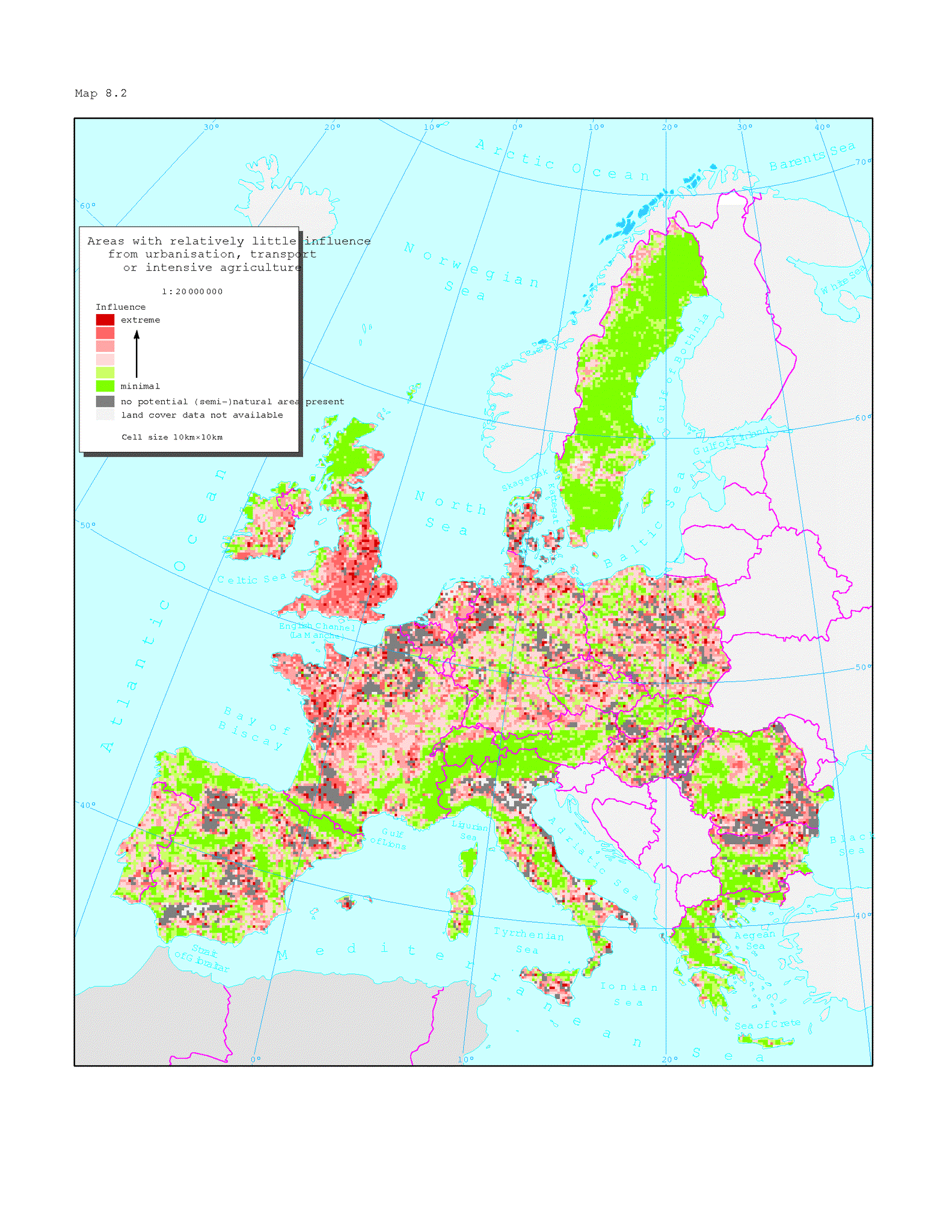
For Great Britain, Finland and Sweden a different methodology has been used, making direct comparisons with the rest of Europe uncertain. Influences from intensive forestry and recreation/tourism not included. The analysis of influences on nature in the map is based on an aggregation of land cover classes for areas with a high potential nature content; i.e. shrubs, heaths, natural grasslands and inland and coastal wetlands. It also includes forests irrespective of management type. These areas are generally susceptible to influences from neighbouring areas with intensive use or which are forming barriers or fragmentation nature areas; i.e. urban and industrial areas, transport structures, intensive agriculture. Water areas (lakes, rivers), grasslands and complex heterogeneous agricultural areas were considered neutral in the analysis = not influencing gravely.


Document Actions
Share with others